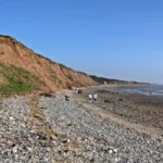
The Hilbre Island walk is a four-mile round-trip coastal trek across the tidal sandbanks of the Dee Estuary in Merseyside, England. The route connects the mainland town of West Kirby to three sandstone islands named Little Eye, Middle Eye, and Hilbre Island.
- How Do Tide Times Control Access to the Hilbre Island Walk?
- What Is the Exact Route and Distance for the Hilbre Island Walk?
- What Safety Rules and Emergency Procedures Apply to the Hilbre Island Walk?
- What Wildlife and Protected Habitats Exist Along the Hilbre Island Walk?
- How Do Facilities, Parking, and Public Transport Serve the Hilbre Island Walk?
- Frequently Asked Questions About the Hilbre Island Walk
The Hilbre Islands Local Nature Reserve sits approximately one mile off the northwest coast of the Wirral Peninsula. The Metropolitan Borough of Wirral manages this 52-hectare Site of Special Scientific Interest under strict environmental conservation laws. The archipelago consists of three distinct Bunter Sandstone outcrops that formed during the Triassic period over 200 million years ago. Little Eye is the smallest island at 0.2 hectares, Middle Eye measures 3.5 hectares, and Hilbre Island spans 4.7 hectares. The Dee Estuary separates the Wirral coastline from Flintshire in North Wales and covers an area of 10,700 hectares.
Human occupation on Hilbre Island dates back to the Neolithic and Roman eras, according to archaeological excavations conducted by the National Museums Liverpool. Benedictine monks established a monastic cell on the main island in the eleventh century as a dependency of St Werburgh’s Abbey in Chester. During the nineteenth century, the Mersey Docks and Harbour Board operated a telegraph station and a lifeboat station on Hilbre Island to monitor maritime traffic entering Liverpool Bay. Today, the archipelago remains uninhabited by permanent residents, although volunteer wardens and ornithologists from the Hilbre Bird Observatory monitor wildlife populations year-round.
How Do Tide Times Control Access to the Hilbre Island Walk?
The Irish Sea experiences a semi-diurnal tidal cycle that floods the Dee Estuary twice every 24 hours and 50 minutes. Walkers must consult official Liverpool Gladstone Dock tide tables to cross the sandbanks safely during the low-water window.
Tidal range in the Dee Estuary reaches up to 10 meters during spring tides and drops to 4 meters during neap tides. The rising tide enters the estuary from Liverpool Bay at speeds exceeding 4 knots, which equals roughly 4.6 miles per hour. Water fills the deep channels between West Kirby and Little Eye first, cutting off the pedestrian causeway long before the surrounding sandbanks submerge. Official maritime authorities, including the National Oceanography Centre and the UK Hydrographic Office, publish daily tide predictions calibrated to the Liverpool Gladstone Dock gauge.
The safe crossing window begins three hours after high water at Liverpool and ends two hours before the next high water. Walkers who remain on Hilbre Island during high tide stay stranded on the sandstone cliffs for up to four hours until the water recedes. Attempting to wade through incoming tidal channels causes rapid hypothermia and drowning due to strong undertows and quicksand pockets. The Royal National Lifeboat Institution station at West Kirby launches its D-class inshore lifeboat over 25 times annually to rescue stranded pedestrians from the archipelago.
What Is the Exact Route and Distance for the Hilbre Island Walk?
The standard Hilbre Island walk covers 4 miles round-trip and requires between 2.5 and 3 hours to complete at a steady pace. The route begins at the West Kirby Marine Lake slipway and follows a marked path across the intertidal flats.

Pedestrians start the journey at Dee Lane in West Kirby, located at postcode CH48 0QG, beside the 52-acre saltwater Marine Lake. Walkers step onto the beach via the concrete slipway at the northern end of the Marine Lake wall and head northwest toward Little Eye. The first leg covers 0.8 miles across firm ribbed sand and shallow saltwater pools to reach Little Eye. From Little Eye, the route continues north-northwest for 0.4 miles across a rocky ridge to reach Middle Eye.
The final stretch spans 0.8 miles from Middle Eye to the southern tip of Hilbre Island along a exposed sandstone shelf. Visitors explore the historic telegraph station, the former buoymaster’s house, and the northern headland cliffs before retracing the exact same path back to West Kirby. Walking directly from the Red Rocks nature reserve at Hoylake to Hilbre Island is unsafe because deep mudflats and fast-flowing water channels block the northern approach. Staying on the established West Kirby corridor ensures firm footing and clear visibility across the entire estuary.
What Safety Rules and Emergency Procedures Apply to the Hilbre Island Walk?
The Maritime and Coastguard Agency enforces strict coastal safety protocols for the Dee Estuary due to rapidly changing weather and tidal hazards. Walkers must carry a fully charged mobile phone, wear waterproof footwear, and check local weather forecasts before departure.
High-visibility clothing and sturdy waterproof boots protect walkers against freezing Irish Sea winds and sharp sandstone barnacles. Fog banks frequently roll in from Liverpool Bay within minutes, reducing visibility to less than 10 meters and disorienting pedestrians on the flat sandbanks. Carrying a magnetic compass or a GPS-enabled smartphone allows walkers to maintain a bearing of 135 degrees southeast back toward the West Kirby shoreline. The Wirral Council displays digital tide warning boards at the Dee Lane slipway, and Hoylake Coastguard Rescue Team patrols the foreshore during peak summer weekends.
If incoming water blocks the return path, walkers must immediately retreat to the highest ground on Hilbre Island rather than attempting to swim or wade. Visitors must dial 999 and ask for the Coastguard to report their exact location on the archipelago. Emergency shelters do not exist on Little Eye or Middle Eye, which makes Hilbre Island the only safe refuge during high-water emergencies. Bringing at least 1 liter of drinking water, high-energy snacks, and an extra thermal layer prevents cold-water shock and dehydration during an unexpected four-hour tidal delay.
What Wildlife and Protected Habitats Exist Along the Hilbre Island Walk?
The Hilbre Islands Local Nature Reserve supports internationally significant populations of Atlantic grey seals and migratory wading birds. The Wildlife and Countryside Act 1981 protects all nesting birds and marine mammals across the Dee Estuary Special Protection Area.

Over 300 species of birds have been recorded at the Hilbre Bird Observatory since its establishment in 1957. During autumn and winter migrations, flocks of over 100,000 waders and wildfowl feed on the mudflats, including knots, dunlins, oystercatchers, curlews, and bar-tailed godwits. Birdwatchers observe purple sandpipers and turnstones roosting along the rocky ledges of Middle Eye during high tide. Visitors must keep dogs on short leads at all times and stay outside fenced roosting zones to prevent disturbing feeding birds.
A resident colony of up to 500 Atlantic grey seals hauls out onto the sandbanks at West Hoyle Bank, located 1 mile west of Hilbre Island. These marine mammals weigh up to 300 kilograms and swim close to the rocky coves of Hilbre Island during the summer pupping and moulting seasons. Under the Marine and Coastal Access Act 2009, pedestrians must maintain a minimum distance of 100 meters from resting seals to avoid triggering stampedes into the water. The British Divers Marine Life Rescue organization monitors the colony and reports any human disturbance to Merseyside Police wildlife crime officers.
How Do Facilities, Parking, and Public Transport Serve the Hilbre Island Walk?
West Kirby serves as the primary transport hub and staging point for the Hilbre Island walk, offering rail links, car parks, and public amenities. Zero toilets, shops, or freshwater taps operate on Little Eye, Middle Eye, or Hilbre Island.
Travelers arriving by train use the Merseyrail Wirral Line to reach West Kirby railway station, which sits 0.3 miles east of the Dee Lane slipway. Trains depart Liverpool Central every 15 minutes and complete the journey to West Kirby in 32 minutes. Motorists park at the Concourse Car Park on Grange Road or along South Parade, where Wirral Council enforces pay-and-display parking fees between 8:00 AM and 6:30 PM. Public restrooms and drinking water refill stations operate inside the West Kirby Concourse Leisure Centre next to the train station.
Visitors must carry out all litter, food wrappers, and dog waste from the islands because Wirral Council provides zero waste bins on the archipelago. The absence of electricity and running water on Hilbre Island preserves its status as an unspoiled wildlife sanctuary. Local cafes and shops along Banks Road and Dee Lane supply hot food, sunscreen, and waterproof gear before walkers step onto the foreshore. Checking Merseyrail weekend engineering schedules and local council parking notices prevents travel delays that compress the safe low-tide walking window.
Frequently Asked Questions About the Hilbre Island Walk
How long does it take to walk to Hilbre Island and back?
The complete round-trip walk from West Kirby Marine Lake to Hilbre Island takes between 2.5 and 3 hours. This timeframe includes 45 minutes of walking each way across the sandbanks plus 60 to 90 minutes to explore the main island.
Can you walk to Hilbre Island at any time of the day?
No, you can only walk to Hilbre Island during low tide when the Dee Estuary sandbanks are fully exposed. You must start your walk at least three hours after high tide and return to West Kirby at least two hours before the next high tide.
Are dogs allowed on the Hilbre Island walk?
Yes, dogs are permitted on the Hilbre Island walk throughout the entire year, provided owners keep them under close control. You must keep dogs on a short lead near roosting wading birds and away from the Atlantic grey seal colony.
Are there any toilets or cafes on Hilbre Island?
There are no toilets, cafes, shops, or drinking water taps anywhere on Little Eye, Middle Eye, or Hilbre Island. All walkers must use the public restrooms and purchase food or water in West Kirby before crossing the beach.
What happens if you get trapped by the tide on Hilbre Island?
If the rising tide cuts off your return route, you must stay on the high sandstone ground of Hilbre Island and never attempt to wade through the water. Dial 999 immediately, ask for the Coastguard, and wait safely for up to four hours until the tide recedes or rescuers arrive.