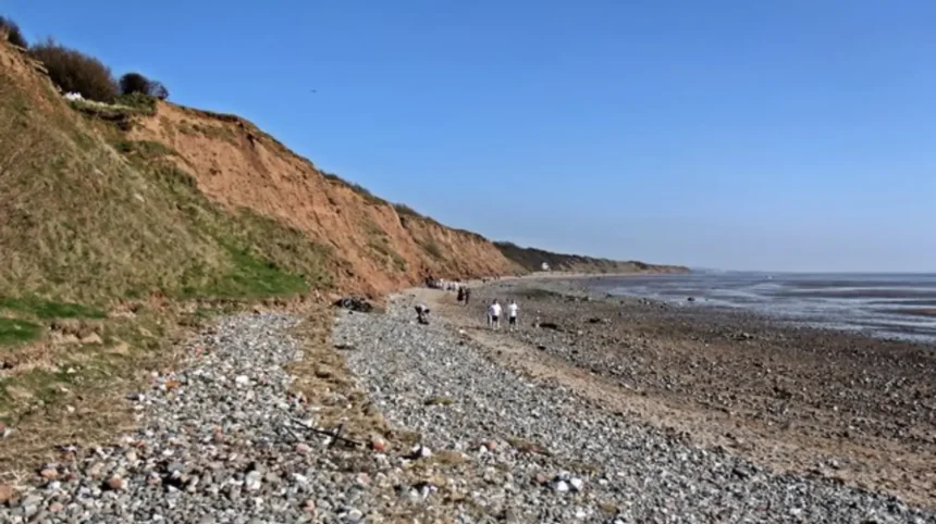
The best beaches in Wirral are West Kirby, New Brighton, Thurstaston, Meols, Hoylake, Moreton, and Red Rocks, offering 25 miles of diverse coastline across the Dee Estuary, Irish Sea, and River Mersey with wide sandy expanses, dramatic red sandstone cliffs, marine lakes, and designated nature reserves managed by Wirral Council.
- What Makes West Kirby Beach Ideal for Views and Water Sports?
- Why Is New Brighton Beach Popular for Family Days Out and Golden Sand?
- Which Beaches in Wirral Are Best for Dog-Friendly Walks?
- What Does Thurstaston Beach Offer for Geology and Coastal Scenery?
- Where Can Visitors Find Quiet Coastal Dunes at Red Rocks and Hoylake?
- How Do Meols and Moreton Beaches Serve Local Walkers and Birdwatchers?
- What Safety Rules and Tide Times Apply to Wirral Beaches?
The Wirral Peninsula is a distinct geographical landmass in North West England situated between the River Dee to the west and the River Mersey to the east. According to Wirral Council environmental records, the peninsula features approximately 25 miles of continuous coastline that attracts over 8 million day visitors annually. Each coastal location provides specific geological features, tidal patterns, and recreational facilities tailored to different visitor needs. The coastline is divided into three primary zones: the Dee Estuary coast, the North Wirral foreshore facing Liverpool Bay, and the Mersey Estuary waterfront.
Historical development of these beaches began in the mid-nineteenth century when the arrival of the Chester and Birkenhead Railway in 1840 and the Mersey Railway tunnel in 1886 transformed quiet fishing villages into major Victorian seaside resorts. Today, Natural England protects vast stretches of this shoreline as Sites of Special Scientific Interest (SSSI) due to internationally significant populations of wading birds. Visitors access these coastal zones via Merseyrail train stations, including West Kirby, Hoylake, Meols, and New Brighton, alongside public car parks operated by local authorities. Understanding the distinct environmental characteristics of each beach ensures visitors select the right destination for sunbathing, coastal photography, or canine recreation.
What Makes West Kirby Beach Ideal for Views and Water Sports?
West Kirby Beach is a two-mile stretch of flat sand located at the mouth of the Dee Estuary, featuring a 52-acre man-made Marine Lake, panoramic views across to Hilbre Island and the Welsh hills, and dedicated facilities for windsurfing, sailing, and coastal walking.
West Kirby sits at the northwestern tip of the Wirral Peninsula, directly facing the Clwydian Range in North Wales across the four-mile-wide Dee Estuary. The focal point of the waterfront is the West Kirby Marine Lake, a saltwater enclosure constructed in 1899 and expanded in 1987 to measure 1.3 miles in perimeter and 5 feet in depth. Because the Marine Lake retains water regardless of the Dee Estuary tidal cycle, it operates year-round for dinghy sailing, windsurfing, paddleboarding, and kayaking through the Wirral Watersports Centre. A 1.3-mile paved promenade walkway encircles the lake, providing level access for pedestrians, cyclists, and wheelchair users.
Beyond the Marine Lake wall lies the main sandy beach, which exposes vast expanses of firm sand and mudflats at low tide. From the shoreline, visitors observe the Hilbre Islands local nature reserve, an archipelago of three tidal islands named Hilbre, Middle Eye, and Little Eye located one mile offshore. Walkers cross the exposed seabed to Hilbre Island during low tide windows, a two-mile route taking approximately 45 minutes each way. Wirral Council enforces strict tide safety protocols, advising walkers to begin their return journey at least three hours before high water to avoid rapid tidal inundation.
Why Is New Brighton Beach Popular for Family Days Out and Golden Sand?
New Brighton Beach is a wide golden sand shoreline at the northeastern tip of the Wirral Peninsula where the River Mersey meets Liverpool Bay, featuring Perch Rock Lighthouse, Fort Perch Rock, a 2.5-mile promenade, and the Marine Point leisure complex.
New Brighton was established as a purpose-built seaside resort in 1830 by Liverpool merchant James Atherton, who purchased 170 acres of coastal sandhills to create a health retreat. The beach stretches from the mouth of the River Mersey westward toward Wallasey Beach, offering clean, soft sand backed by a concrete seawall and promenade. At the eastern end stands Perch Rock Lighthouse, a 95-foot-tall Anglesey limestone tower completed in 1830 that sits on a rocky outcrop accessible on foot at low tide. Adjacent to the lighthouse is Fort Perch Rock, a coastal defense battery built between 1825 and 1829 to protect the Port of Liverpool from naval attacks.
Following a 60 million pound regeneration project completed in 2011, the New Brighton seafront integrates traditional coastal features with modern visitor infrastructure. The Marine Point development sits directly opposite the beach, housing restaurants, a cinema, a supermarket, and the Floral Pavilion Theatre. Along the waterfront, the Black Pearl pirate ship, a community-built driftwood sculpture constructed from washed-up timber, serves as a major landmark for families. New Brighton holds a Seaside Award from Keep Britain Tidy, recognizing its high standards of beach cleanliness, water quality monitoring by the Environment Agency, and lifeguard coverage provided by the Royal National Lifeboat Institution (RNLI) during peak summer months.
Which Beaches in Wirral Are Best for Dog-Friendly Walks?
All beaches in Wirral welcome dogs year-round without seasonal bans, with Thurstaston Beach, North Wirral Coastal Park at Moreton, Red Rocks, and Hoylake offering expansive sand, grassy dunes, and direct connections to the 12-mile Wirral Way footpath for off-lead exercise.
Unlike many coastal local authorities in the United Kingdom that enforce Public Spaces Protection Orders (PSPOs) banning dogs between May and September, Wirral Council permits dogs on all its beaches 365 days a year. Owners are only required to keep dogs on leads in specific sensitive zones, such as around the high-tide roosting areas at Hoylake and West Kirby during winter bird migration periods, and inside enclosed children play areas. This open-access policy makes the peninsula a primary destination for dog owners across Merseyside, Cheshire, and North Wales.
Thurstaston Beach, located on the Dee Estuary shoreline beneath the 250-acre Wirral Country Park, provides a mix of pebble-strewn sand, clay cliffs, and wooded trails. Dog walkers park at the Thurstaston Visitor Centre on Station Road and follow steep paths down to the shore, where low tide reveals miles of quiet estuary sand. For flat terrain, the North Wirral Coastal Park stretches four miles between Meols and New Brighton, combining wide sandy beaches at Leasowe and Moreton with grassy coastal meadows and sand dunes. These routes link directly to the Wirral Way, a traffic-free footpath and bridleway built along the trackbed of the former Birkenhead Railway line that closed in 1962.
What Does Thurstaston Beach Offer for Geology and Coastal Scenery?
Thurstaston Beach features 60-foot-tall glacial boulder clay cliffs, ancient red Triassic sandstone outcrops, and panoramic views across the Dee Estuary toward Wales, forming part of the protected Dee Estuary Site of Special Scientific Interest and Wirral Country Park.
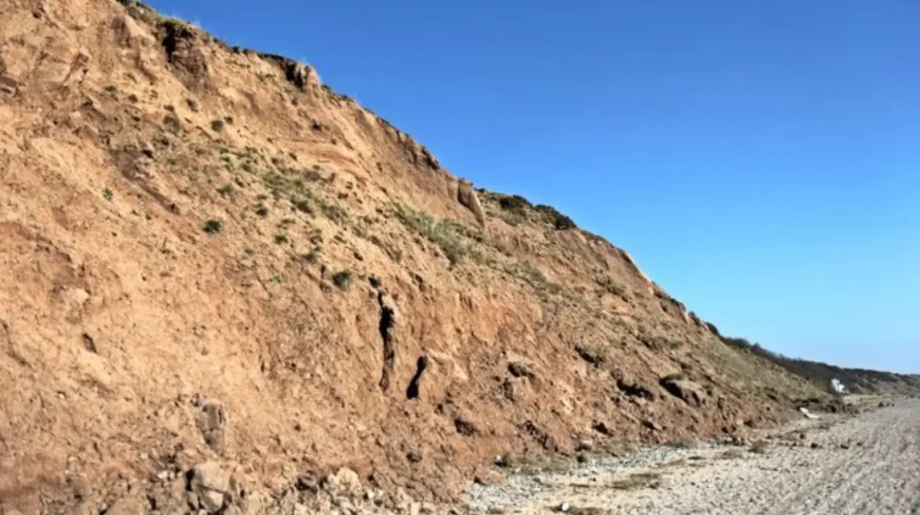
Located three miles south of West Kirby along the western shore of the peninsula, Thurstaston presents a rugged, undeveloped coastline contrasting sharply with the commercialized promenades of New Brighton. The beach is backed by dramatic cliffs composed of Devensian glacial till, a mixture of boulder clay, sand, and gravel deposited by retreating ice sheets approximately 15,000 years ago. Continuous wave action from the Dee Estuary erodes these soft cliffs, creating natural gullies and exposing glacial erratic boulders transported from the Lake District and Scotland during the last Ice Age.
At the southern boundary of the beach lies Dungeon Wood, a steep wooded ravine containing a freshwater stream that cuts through the sandstone bedrock to reach the estuary. Above the beach sits Wirral Country Park, which opened in October 1973 as the first designated country park in Britain. The park encompasses 250 acres of clifftop grassland, scrub, and woodland, offering elevated viewing platforms equipped with binoculars for observing estuary wildlife. Up to 130,000 wintering waterbirds, including dunlin, knot, oystercatchers, and black-tailed godwits, feed on the intertidal mudflats directly in front of Thurstaston Beach between September and March.
Where Can Visitors Find Quiet Coastal Dunes at Red Rocks and Hoylake?
Red Rocks Beach sits between Hoylake and West Kirby at the northwestern corner of Wirral, featuring 230-million-year-old Triassic red sandstone outcrops, protected sand dunes, and a Site of Special Scientific Interest supporting rare natterjack toads and coastal flora.
Red Rocks takes its name from the exposed formations of Helsby Sandstone Formation bedrock laid down during the Triassic period when the region was an arid desert basin. These weathered red rock ledges border the sandy shoreline and provide sheltered rock pools at low tide. Behind the beach lies a 10-hectare coastal sand dune system managed by the Cheshire Wildlife Trust as a nature reserve. This habitat sustains one of the last remaining populations of the protected natterjack toad in North West England, alongside rare coastal plants such as sea holly, pyramidal orchid, and Portland spurge.
Immediately east of Red Rocks stretches Hoylake Beach, a wide expanse of flat sand fronted by the North Parade promenade and the Royal Liverpool Golf Club, which has hosted The Open Championship 13 times since 1897. Hoylake Beach has undergone significant ecological change since Wirral Council ceased mechanical beach raking in 2019 to comply with Natural England SSSI conservation guidelines. As a result, natural saltmarsh vegetation and pioneer dunes have colonized sections of the upper foreshore, creating a dynamic coastal ecosystem that stabilizes the shoreline against storm surges while leaving open sandy channels toward the low-water mark.
How Do Meols and Moreton Beaches Serve Local Walkers and Birdwatchers?
Meols and Moreton Beaches form the central section of the North Wirral foreshore along Liverpool Bay, offering uncrowded sandy beaches, concrete sea defenses, historic submerged forest remains, and direct access to the 400-acre North Wirral Coastal Park.
Meols Beach sits between Hoylake and Leasowe, functioning as a quiet residential beachfront with free street parking along Bennett Lane and Meols Parade. Historically, Meols was one of the most important trading ports in Roman and medieval Britain, with archaeological excavations recovering over 3,000 artifacts including Roman coins, Saxon brooches, and Viking weapons from the eroding shoreline. At extreme low spring tides, visitors can observe the remains of a prehistoric submerged forest near Dove Point, consisting of ancient oak and pine tree stumps preserved in peat beds dating back 4,500 years.
Moving east from Meols leads directly to Moreton Beach and Leasowe Bay, which are protected by the Wallasey Embankment, a 2.5-mile sloping stone seawall constructed between 1829 and 1835 to prevent the Irish Sea from flooding the low-lying North Wirral plain. Behind the embankment lies Leasowe Lighthouse, built in 1763 by the Mersey Docks and Harbour Board, making it the oldest brick-built lighthouse in Britain. Moreton Beach features a wide sandy foreshore backed by natural marram grass sand dunes, providing sheltered sunbathing spots in summer and clear views of offshore wind farms like Burbo Bank in Liverpool Bay.
What Safety Rules and Tide Times Apply to Wirral Beaches?
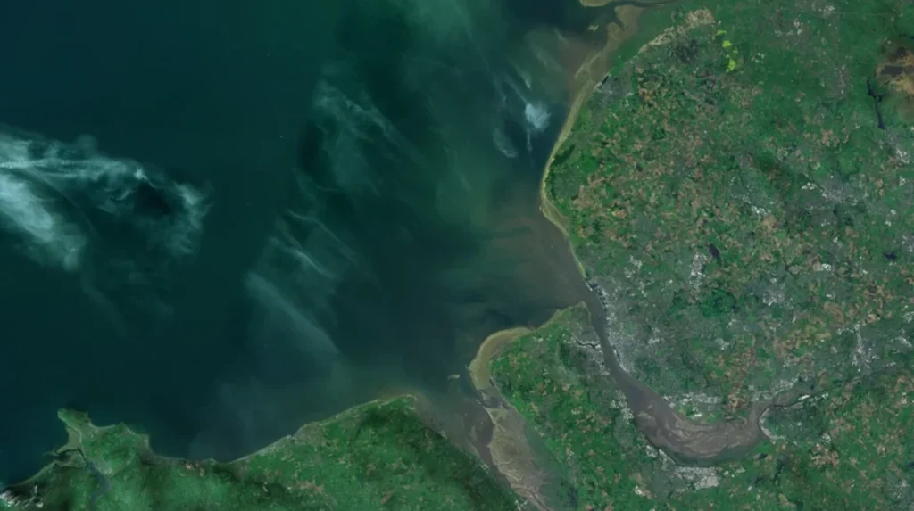
Wirral beaches experience a macro-tidal range exceeding 32 feet during spring tides, requiring visitors to check official tide tables, observe RNLI lifeguard red and yellow flags, and avoid fast-flowing tidal channels and soft estuary mudflats.
The coastline of the Wirral Peninsula sits within Liverpool Bay, which possesses the second-highest tidal range in the United Kingdom after the Severn Estuary. During spring tides, the sea level rises and falls by up to 10 meters (32.8 feet) within a six-hour cycle, causing the waterline to advance across flat beaches like West Kirby, Hoylake, and Moreton faster than a person can walk. Visitors must consult official UK Hydrographic Office tide predictions for Liverpool (Gladstone Dock) or Hilbre Island before walking out onto exposed sandbanks.
To maintain public safety, the Royal National Lifeboat Institution operates seasonal lifeguard patrols at West Kirby, New Brighton, Moreton, and Leasowe Common between May and September, daily from 10:00 AM to 6:00 PM. Lifeguards designate safe swimming and bodyboarding zones using red and yellow flags, while black and white checkered flags mark areas reserved for watercraft like kayaks and windsurfers. Visitors must avoid walking across dark mud patches in the Dee Estuary, particularly near Thurstaston and Heswall, where deep alluvial silt presents a severe entrapment hazard. Emergency coastal rescues are coordinated by HM Coastguard via 999 calls, supported by lifeboat stations located at West Kirby, Hoylake, and New Brighton.
Which Wirral beach is best for dogs?
Thurstaston Beach and Moreton Beach are the best Wirral beaches for dogs because Wirral Council allows dogs on all beaches year-round with zero seasonal bans. Both locations offer wide sandy foreshores, grassy coastal dunes, and direct access to traffic-free footpaths like the Wirral Way.
Can you swim at West Kirby beach?
Yes, you can swim at West Kirby Beach during high tide when RNLI lifeguards are on duty between May and September inside the red and yellow flagged zone. Many open-water swimmers also use the 52-acre West Kirby Marine Lake, which provides calm, enclosed saltwater conditions year-round.
Is parking free at Wirral beaches?
Parking is free at several Wirral beaches, including Leasowe Common, Gunsite Car Park in Moreton, Meols Parade, and sections of North Parade in Hoylake. Other popular spots like West Kirby Concourse, Thurstaston Visitor Centre, and Marine Point in New Brighton operate pay-and-display parking fees.
How long does it take to walk to Hilbre Island from West Kirby?
Walking from West Kirby Beach to Hilbre Island takes approximately 45 minutes to one hour each way across two miles of exposed sand. Walkers must check official tide tables and leave Hilbre Island at least three hours before high tide to avoid getting cut off by rising water.
Which Wirral beach has the best sand?
New Brighton Beach and Moreton Beach have the best soft, golden sand on the Wirral Peninsula, making them ideal for families and sunbathing. Unlike the mudflats found along the upper Dee Estuary, the North Wirral foreshore faces the Irish Sea and retains clean, dry sand near the dunes.