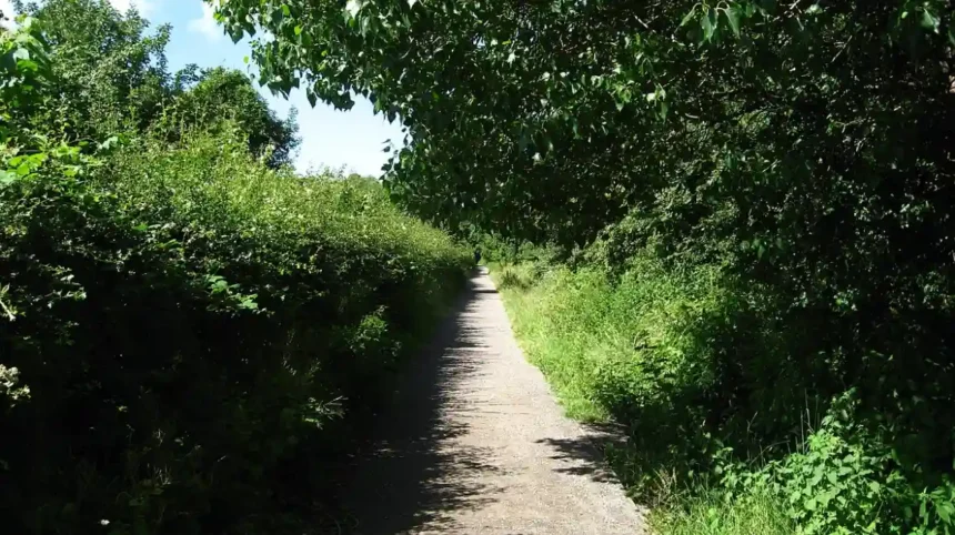
The Wirral Way is a 12-mile traffic-free walking and cycling path following a disused railway line across the Wirral Peninsula. It stretches from West Kirby in Merseyside to Hooton in Cheshire, forming the core spine of Wirral Country Park.
- How Did the Wirral Way Develop From a Historic Railway Line?
- What Are the Best Sections and Exact Distances Along the Wirral Way?
- Section 1: West Kirby to Thurstaston (3.5 Miles / 5.6 Kilometers)
- Section 2: Thurstaston to Parkgate (3.2 Miles / 5.1 Kilometers)
- Section 3: Parkgate to Willaston (3.0 Miles / 4.8 Kilometers)
- Section 4: Willaston to Hooton (2.5 Miles / 4.0 Kilometers)
- Which Cafés and Refreshment Stops Are Located Along the Route?
- What Wildlife and Ecological Habitats Exist Within Wirral Country Park?
- How Can Visitors Plan Transport, Parking, and Accessibility on the Trail?
- Frequently Asked Questions About the Wirral Way
The Wirral Way functions as a flat, accessible multi-user trail managed jointly by Wirral Council and Cheshire West and Chester Council. The route spans exactly 12.2 miles, which equals 19.6 kilometers of dedicated recreational corridor. For approximately 7 miles between West Kirby and Parkgate, the path runs parallel to the River Dee estuary, offering unobstructed views toward the Welsh hills. South of Neston, the trail turns inland through wooded cuttings and agricultural fields until terminating directly beside Hooton railway station. Because it occupies a former railway trackbed, the gradient remains consistently gentle across the entire length, eliminating steep climbs for walkers, cyclists, and wheelchair users.
The corridor sits within Wirral Country Park, which holds legal designation under the Countryside Act of 1968. Two distinct local authorities maintain separate sections of the path, dividing responsibility near the village of Ness. The northern section lies within the Metropolitan Borough of Wirral, while the southern section falls under Cheshire West and Chester. Three primary user groups share this corridor, including pedestrians, cyclists, and horse riders who utilize parallel bridleway tracks on specific stretches. Additionally, the path forms a vital segment of the 35-mile Wirral Circular Trail and connects directly to National Cycle Network Route 56.
How Did the Wirral Way Develop From a Historic Railway Line?
The Wirral Way originated as the Hooton to West Kirby branch railway line, built in two stages between 1866 and 1886. Following passenger closures in 1956 and freight closures in 1962, authorities transformed the corridor into Britain’s first designated country park.
The Birkenhead Joint Railway Companies opened the initial southern stretch between Hooton and Parkgate in 1866, operating six daily passenger trains to connect rural communities with Chester and Birkenhead. Twenty years later, in 1886, the London and North Western Railway and Great Western Railway extended the track northwards to West Kirby. This expansion introduced four additional intermediate stations, specifically at Heswall, Thurstaston, Caldy, and Kirby Park. By the mid-twentieth century, rising private car ownership and competing bus networks caused severe passenger decline along the branch line. British Railways terminated regular passenger services in September 1956, and final freight operations ceased completely in May 1962.
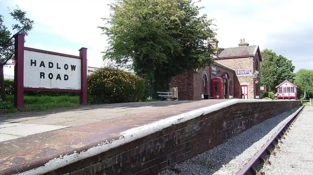
Following track removal, local conservationists led by Captain Lawrence Beswick campaigned to prevent the derelict railway cutting from becoming an illegal dumping ground. Cheshire County Council adopted the Wirral Green Belt Council proposal in April 1968, securing funding from the Countryside Commission. Workers removed 30 miles of iron rails and wooden sleepers, installed new drainage systems, and laid thousands of tons of compacted gravel. Major Frank White became the first Head Ranger in July 1969, overseeing site preparation before the official public opening on October 2, 1973. Today, historical railway artifacts remain visible along the trail, including original brick bridges, gradient markers, and the preserved 1950s station building at Hadlow Road.
What Are the Best Sections and Exact Distances Along the Wirral Way?
The Wirral Way divides into four distinct walking sections ranging from 2.5 miles to 4.2 miles each. Walkers select segments based on scenery preferences, choosing between open coastal estuary cliffs in the north and sheltered woodland cuttings in the south.
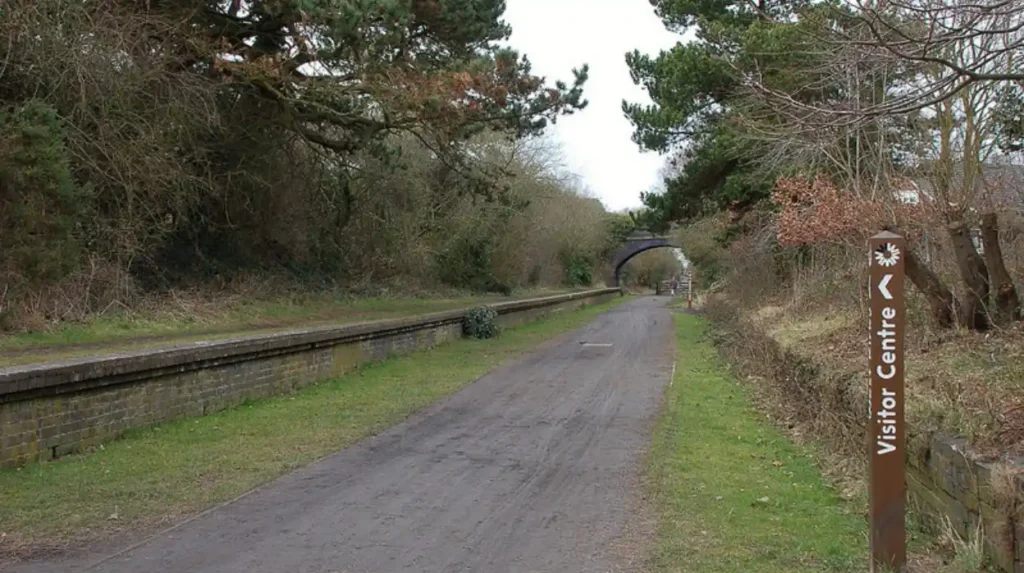
Section 1: West Kirby to Thurstaston (3.5 Miles / 5.6 Kilometers)
This northernmost section begins at the West Kirby trailhead on Orrysdale Road, located 400 meters from West Kirby Merseyrail station. Walkers travel south past Ashton Park and through the affluent suburb of Caldy, where high sandstone cuttings shelter the path from coastal winds. After passing the former Kirby Park station site, the route emerges onto elevated clay cliffs overlooking the River Dee estuary. This stretch provides direct views across the tidal saltmarshes toward Hilbre Island and the Clwydian Range in North Wales. The section concludes at the Wirral Country Park Visitor Centre in Thurstaston, taking approximately 75 minutes at a standard walking pace.
Section 2: Thurstaston to Parkgate (3.2 Miles / 5.1 Kilometers)
Continuing south from Thurstaston, the trail hugs the edge of the Dee Cliffs Site of Special Scientific Interest. Walkers pass the historic Old Baths site and traverse quiet sections bordering Heswall Golf Club before encountering a brief road diversion in Lower Heswall. Because a short stretch of the original railway embankment between Davenport Road and Riverbank Road entered private ownership, signposts direct walkers along quiet residential lanes for 600 meters. Rejoining the trackbed leads directly to Station Road in Parkgate, famous for its sandstone sea wall and expansive marshland. This flat coastal segment requires roughly 65 minutes to complete on foot.
Section 3: Parkgate to Willaston (3.0 Miles / 4.8 Kilometers)
At Parkgate, the route leaves the immediate coastline and curves inland through the market town of Neston. Walkers navigate a short on-road link along Mellock Lane before entering the deep sandstone excavation known as Neston Rock Cutting. Mature oak, ash, and sycamore trees form a dense canopy overhead, creating a sheltered woodland corridor rich in spring wildflowers and woodland birds. The path crosses over rural farmland and passes beneath Victorian brick arch bridges before arriving at Hadlow Road Station in Willaston. Completing this transitional section takes approximately 60 minutes.
Section 4: Willaston to Hooton (2.5 Miles / 4.0 Kilometers)
The final southern segment runs entirely through peaceful Cheshire countryside between Willaston and Hooton. This section features wide, well-drained gravel surfaces bordered by hedgerows, agricultural pastures, and small pockets of semi-ancient woodland. Walkers experience minimal elevation change while passing historic railway mileposts and original boundary fencing from the 1866 Birkenhead Joint Railway. The trail terminates at a dedicated wooden gateway directly opposite Hooton railway station on the Merseyrail Wirral Line. This quiet rural stretch takes roughly 50 minutes to walk from end to end.
Which Cafés and Refreshment Stops Are Located Along the Route?
Seven primary cafés and refreshment venues operate directly on or within 300 meters of the Wirral Way. These establishments provide hot meals, specialty coffee, baked goods, and public restroom facilities at regular intervals between West Kirby and Hooton.
At the northern trailhead in West Kirby, walkers access numerous independent coffee shops along Banks Road and Grange Road, including Hickory’s Smokehouse café kiosk and Sweet Pea Café. Moving 3.5 miles south, the Flissy’s Coffee Shop at Thurstaston sits directly adjacent to the Wirral Country Park Visitor Centre and main car park. Flissy’s operates seven days a week, serving full breakfasts, homemade cakes, and hot drinks with outdoor seating overlooking the Dee Estuary. Nearby on Station Road in Thurstaston, the Cottage Loaf public house offers traditional hot lunches and refreshments just 200 meters inland from the trail.
Further south along the Parkgate Parade, located 400 meters from the Station Road access point, walkers find Nicholls Famous Ice Cream and the Boathouse restaurant. Nicholls has produced artisan dairy ice cream on-site since 1940, making it a primary refreshment stop during warmer months. At the 9.7-mile mark in Willaston, the Hadlow Road Station refreshment kiosk operates inside the restored 1950s ticket office on weekends and bank holidays. Finally, Hooton village provides convenience stores and the Hooton Hotel pub directly beside the southern terminus for walkers awaiting return trains.
What Wildlife and Ecological Habitats Exist Within Wirral Country Park?
Wirral Country Park protects four internationally and nationally designated conservation zones, including the Dee Estuary Ramsar Site and Dee Cliffs Site of Special Scientific Interest. These habitats support over 120,000 wintering waterbirds alongside resident mammals, amphibians, and rare coastal insects.
The adjacent Dee Estuary holds multiple statutory protections, including Special Protection Area, Special Area for Conservation, and Ramsar wetland status. During autumn and winter migrations, the intertidal mudflats and saltmarshes host massive flocks of wading birds, such as oystercatchers, curlews, redshanks, and black-tailed godwits. Birdwatchers utilize two dedicated wooden viewing hides located near the Thurstaston Visitor Centre to observe high-tide roosts without disturbing wildlife. Within the estuary sediment, dense populations of lugworms, ragworms, and cockles provide essential food sources for these migratory avian species.
Along the terrestrial railway embankments, unimproved maritime grassland and semi-ancient woodland create a continuous wildlife corridor across the peninsula. Woodland sections shelter resident mammals, including European badgers, red foxes, grey squirrels, and pipistrelle bats that roost inside old brick railway bridges. Entomologists have recorded ten distinct butterfly species along the sunny south-facing cuttings, such as speckled wood, peacock, and gatekeeper butterflies. Additionally, park rangers maintain freshwater ponds near Thurstaston to support breeding populations of smooth newts, common frogs, and dragonflies.
How Can Visitors Plan Transport, Parking, and Accessibility on the Trail?
Visitors access the Wirral Way via two Merseyrail train stations at West Kirby and Hooton, alongside six official public car parks. Over 85 percent of the trail features compacted level surfaces suitable for wheelchairs, mobility scooters, and family pushchairs.
Public transport provides the most efficient logistics for linear one-way walks across the entire 12.2-mile distance. Merseyrail operates regular electric trains every 15 minutes from Liverpool Central to both West Kirby and Hooton stations. Walkers arriving by train at West Kirby walk 400 meters along Grange Road and Orrysdale Road to reach the northern entrance. Upon completing the route at Hooton, the southern trail exit sits directly across the station approach road, allowing seamless return journeys via Chester or Birkenhead lines. Local Stagecoach and Arriva bus routes also serve intermediate villages, including Heswall, Parkgate, and Neston.
Drivers find dedicated parking facilities at six strategic access points, including West Kirby Concourse, Cubbins Green in Caldy, Thurstaston Visitor Centre, Station Road in Parkgate, Hadlow Road Station in Willaston, and Hooton Station. The main Thurstaston Visitor Centre car park accommodates 150 vehicles, features designated blue badge spaces, and provides accessible public toilets. While the former railway bed remains predominantly flat and wide, wheelchair users should note three short on-road diversions at Lower Heswall, Parkgate, and Neston that involve standard pavement gradients.
Frequently Asked Questions About the Wirral Way
How long does it take to walk the entire Wirral Way?
Walking the full 12.2-mile distance from West Kirby to Hooton takes between 4 and 4.5 hours at an average pace of 3 miles per hour. Most casual walkers add an extra 45 minutes to stop for refreshments at Thurstaston or Parkgate.
Is the Wirral Way flat and suitable for wheelchairs or prams?
Yes, the trail follows a disused railway trackbed, making the vast majority of the 12-mile route flat, wide, and surfaced with compacted gravel. Users with wheelchairs or prams should plan around three brief road diversions in Lower Heswall, Parkgate, and Neston where standard pavements are used.
Are dogs allowed on the Wirral Way and inside the cafés?
Dogs are welcome along the entire length of the Wirral Way, though owners must keep pets on short leads near livestock fields, horse riders, and wildlife hides. Several trailside venues, including Flissy’s Coffee Shop at Thurstaston and The Cottage Loaf pub, offer dog-friendly outdoor seating areas.
Can you cycle the Wirral Way and do you have to give way to walkers?
Cycling is permitted along the entire 12-mile route as part of National Cycle Network Route 56. Because it is a shared-use path, cyclists must adhere to the Countryside Code, use bells when approaching pedestrians from behind, and yield priority to walkers and horse riders.
Which end of the Wirral Way is better to start from?
Starting at Hooton and walking north toward West Kirby is generally preferred because the dramatic coastal views across the Dee Estuary open up progressively during the second half of the walk. Ending in West Kirby also provides immediate access to marine lake walks, beaches, and frequent Merseyrail trains.