

The Halton Council area is a unitary authority district located in Cheshire, England, spanning the towns of Widnes and Runcorn across the River Mersey. Established under the Local Government Act 1972, the borough serves an estimated population of over 128,000 residents across an area of approximately 79 square kilometers. Halton forms an integral part of the Liverpool City Region, functioning as an essential industrial, commercial, and transport node in North West England.
- How did the Halton Council area develop historically?
- What are the key structural components of the Halton local authority?
- How does the local economy and infrastructure operate in Halton?
- Which major attractions and landmarks define the Halton area?
- What statistical data characterizes the demographic profile of Halton?
- What future developments and plans affect the Halton Council region?
- Frequently Asked Questions
Halton Council operates as a single-tier local authority, exercising full administrative responsibility for local services including education, social care, planning, waste management, and highways infrastructure. Geographically, the borough is defined by its position on both the north and south banks of the River Mersey. Widnes occupies the northern bank within the historic boundaries of Lancashire, while Runcorn sits on the southern bank within the historic county boundaries of Cheshire.
The borough incorporates smaller rural settlements including Hale, Daresbury, and Moore. The area features key transport arteries such as the M56 motorway, the A562 road, and the West Coast Main Line railway. The administrative hub operates from Municipal Building in Widnes and Runcorn Town Hall. Local governance is managed through a council composed of 54 elected councillors representing 18 electoral wards.
How did the Halton Council area develop historically?
The Halton Council area evolved from early medieval fortifications and industrial expansion during the Industrial Revolution to a modern unitary authority established in 1974. The area transformed from agricultural manors and chemical production centers into a structured municipal borough through successive local government reforms. Historic developments laid the foundation for current infrastructure and urban settlement patterns across both sides of the River Mersey.
The administrative history of Halton began with early settlements around Halton Castle, built in 1070 by the Barons of Halton as a Norman stronghold. During the nineteenth century, Widnes and Runcorn emerged as major industrial hubs. Widnes became a global center for the alkali manufacturing industry following the opening of chemical works in 1847. Runcorn developed around soap, tanning, and chemical industries aided by the opening of the Bridgewater Canal in 1761 and the Runcorn and Weston Canal in 1853.
The Local Government Act 1972 formally created the District of Halton on April 1 1974 by merging the Borough of Widnes, the Urban District of Runcorn, and parts of Whiston Rural District and Runcorn Rural District. Halton originally operated as a non-metropolitan district within Cheshire. On April 1 1998, Halton gained unitary authority status, separating administratively from Cheshire County Council while remaining within Cheshire for ceremonial purposes. In April 2014, Halton joined five Merseyside boroughs to form the Liverpool City Region Combined Authority.
What are the key structural components of the Halton local authority?
The structural components of Halton consist of distinct urban zones, administrative divisions, parish councils, and dedicated transport linkages across the River Mersey. The borough is divided into 18 municipal wards served by local government departments, four civil parishes, and specific development zones designed for industrial and commercial activities. These elements function collectively under a cabinet-style executive governance system led by an elected Council Leader and Chief Executive.
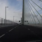
Halton is divided into two principal urban centers separated by the River Mersey and connected by major bridge structures. Widnes comprises residential and commercial sectors including Kingsway, Appleton, Hough Green, Farnworth, and the 3MG Mersey Multimodal Gateway logistics park. Runcorn comprises the Old Town district and the New Town expansion built following Runcorn New Town designation in 1964. Runcorn New Town features distinct residential estates such as Castlefields, Murdishaw, Windmill Hill, and the Shopping City commercial core. The rural east of the borough includes the civil parishes of Daresbury, Moore, Hale, and Sandymoor. Local public services are administered through primary directorates including the Adults Directorate, Children Directorate, and Environment and Regeneration Directorate. Transport connectivity between northern and southern sectors relies on the Silver Jubilee Bridge, opened in 1961, and the Mersey Gateway Bridge, opened in October 2017.
How does the local economy and infrastructure operate in Halton?
The Halton economy operates through advanced manufacturing, chemical production, science research, logistics, and major crossing infrastructure across the River Mersey. Strategic transport corridors allow low-cost freight distribution across the United Kingdom, while specialized industrial parks generate thousands of technical jobs. Modern investments focus on digital innovation, renewable energy transition, and large-scale commercial real estate regeneration.
Economic activities in Halton center on specialized research and industrial facilities. The Sci-Tech Daresbury campus serves as an international science and innovation hub, hosting over 150 high-tech companies and national facilities including the STFC Daresbury Laboratory. Chemical manufacturing remains a core sector, represented by major operations at the Heath Business and Technical Park in Runcorn.
Freight transport operations utilize the 3MG Mersey Multimodal Gateway in Widnes, a 200-acre intermodal logistics hub offering direct rail linkage to the West Coast Main Line and United Kingdom sea ports. Infrastructure operations are governed by major transport networks, including the toll-funded Mersey Gateway Bridge which carries over 80,000 vehicles per day. Commercial activity is supported by regional retail developments such as Widnes Shopping Park and Runcorn Shopping City.
Which major attractions and landmarks define the Halton area?
Major attractions in Halton include historic monuments, industrial heritage museums, natural reserves, and large public parks distributed across Widnes and Runcorn. These sites preserve local heritage, support biodiversity, and provide public leisure facilities for regional visitors. The landmarks span centuries of engineering history, medieval defense systems, and nature conservation initiatives.
Halton features key cultural and natural landmarks across both sides of the river. Halton Castle stands atop Halton Hill in Runcorn, displaying preserved sandstone ruins dating back to the eleventh century. Nearby Norton Priory Museum and Gardens contains the excavated ruins of an Augustinian abbey founded in 1115, surrounded by 42 acres of historic woodland and a restored walled garden.
Catalyst Science Discovery Centre in Widnes operates as the only museum in the United Kingdom dedicated solely to chemistry and industrial science, offering interactive exhibits overlooking the River Mersey. Spike Island in Widnes provides green space along the Sankey Canal, site of the first modern British canal opened in 1757. Victoria Park in Widnes offers formal gardens, a historic bandstand, and a restored glasshouse. Additional nature reserves include Wigg Island Community Park, situated between the River Mersey and the Manchester Ship Canal, and Pickering Pasture along the Mersey estuary.
What statistical data characterizes the demographic profile of Halton?
Statistical data characterizes Halton as a urban borough with an estimated population of 128,471 according to official census statistics. The area demonstrates high population density, structured demographic distribution, and clear economic metrics tracked by national statistical agencies. Demographic data guides public resource allocation, housing strategies, and infrastructure investments across local council wards.

Data from the Office for National Statistics indicates that Halton covers an area of 79.1 square kilometers, resulting in a population density of approximately 1,624 persons per square kilometer. The population distribution shows approximately 51 percent female residents and 49 percent male residents. Age demographics reveal that 18.5 percent of the population is aged under 15 years, 62.3 percent is aged 15 to 64 years, and 19.2 percent is aged 65 years and over. The borough contains approximately 56,000 households. Employment statistics show an economically active rate of 76.5 percent among residents aged 16 to 64 years. Median weekly earnings for full-time workers residing in Halton stand at approximately 610 pounds sterling. Housing metrics reflect a tenure split with approximately 64 percent owner-occupied properties, 22 percent social rented housing, and 14 percent private rented accommodation.
What future developments and plans affect the Halton Council region?
Future developments in Halton focus on town center regeneration, sustainable transport integration, housing expansion, and industrial decarbonization projects. Planning strategies set out by Halton Borough Council aim to enhance economic growth while reducing carbon emissions through designated development zones. Future frameworks align local initiatives with broader Liverpool City Region development programs.
Future development in the borough is guided by the Halton Local Plan, which establishes policies for land use and construction up to 2037. Key development initiatives include the Runcorn Station Quarter Regeneration scheme, designed to upgrade transport connections, pedestrian routes, and commercial spaces around Runcorn railway station. Housing expansion projects target the construction of over 8,000 new residential units across allocated sites, including East Runcorn and Sandymoor. Economic growth strategy focuses on expanding Sci-Tech Daresbury to create over 10,000 technical jobs over two decades. Industrial decarbonization initiatives center on the HyNet North West project, which uses carbon capture and hydrogen energy infrastructure to transition local chemical industries toward net-zero emissions by 2050.
Frequently Asked Questions
What is Halton Council responsible for in Cheshire?
Halton Borough Council acts as a unitary authority providing all primary public services across Widnes and Runcorn. Responsibilities include social care, primary and secondary education, waste collection, local planning approvals, and road maintenance. The council functions independently from Cheshire County Council while remaining inside Cheshire for ceremonial duties.
How do you cross between Widnes and Runcorn?
Vehicular travel between Widnes and Runcorn relies on the Mersey Gateway Bridge and the Silver Jubilee Bridge across the River Mersey. Both crossings utilize a smart tolling system called Merseyflow, requiring registration or prompt payment online. Local buses and West Coast Main Line train services also connect the two towns regularly.
Is Halton part of Liverpool or Cheshire?
Halton is administratively part of the Liverpool City Region Combined Authority while belonging to the ceremonial county of Cheshire. The borough sits on the boundary between historic Lancashire and Cheshire, combining industrial links to Merseyside with historic geographical ties to Cheshire.
What are the main attractions to visit in Halton?
Top attractions in the borough include Norton Priory Museum and Gardens, Halton Castle ruins, and the Catalyst Science Discovery Centre. Outdoor spaces such as Spike Island, Victoria Park, and Wigg Island offer walking routes along canals and estuaries.