
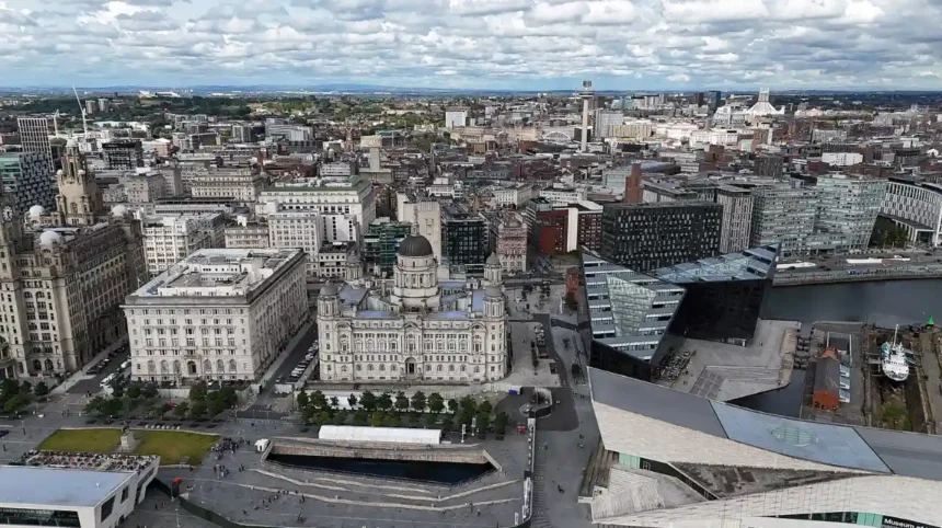
Travelling from Liverpool City Centre to Kensington involves traversing approximately 1.5 miles eastbound along major urban thoroughfares. The route connects the commercial core of Liverpool with the inner-city residential and academic district of Kensington. Travel times range from 5 minutes by car or taxi to 30 minutes on foot. Public transit options operate continuously throughout the day with frequent service schedules.
- How Do You Travel by Bus from Liverpool City Centre to Kensington?
- Can You Take a Train from Liverpool City Centre to Kensington?
- What Is the Walking Route from Liverpool City Centre to Kensington?
- How Long Does It Take to Drive or Take a Taxi to Kensington?
- What Are the Cycling Options Between Liverpool City Centre and Kensington?
- Frequently Asked Questions
- What is the fastest way to get from Liverpool City Centre to Kensington?
- How much does a bus ticket cost from Liverpool City Centre to Kensington?
- Is Kensington Liverpool within walking distance from Lime Street Station?
- Which bus stop in Liverpool City Centre goes to Kensington?
- Does Merseyrail run direct trains to Kensington?
Liverpool City Centre serves as the primary economic, retail, and transit hub for the City of Liverpool region. Kensington is an inner-city suburb located in the L7 postal district, immediately east of the Knowledge Quarter. The spatial connection between these two areas relies on historical transport corridors including Kensington road, Prescot Street, and London Road. Transportation infrastructure in this corridor supports daily commuters, healthcare professionals, and University of Liverpool students.
Historical transit along this corridor developed during the nineteenth century as Liverpool expanded eastward from the River Mersey. Streetcar networks initially serviced London Road to accommodate residential growth in Kensington. Today, the route forms a critical transit artery managed by Merseytravel, Liverpool City Council, and regional bus operators. The road layout provides direct access to Edge Lane, connecting the city centre directly to the M62 motorway network.
The movement of commuters between these two districts relies on three main modes of transport: public bus services, road vehicles, and walking. Infrastructure along London Road and Kensington includes dedicated bus lanes, signalised pedestrian crossings, and paved footpaths. Transport options accommodate high volume passenger traffic during peak morning and evening travel periods.
Understanding the spatial layout, operational schedules, and travel parameters enables efficient navigation between these urban centres. Route selection depends on destination points within Kensington, time constraints, budget considerations, and personal mobility preferences.
How Do You Travel by Bus from Liverpool City Centre to Kensington?
Bus travel from Liverpool City Centre to Kensington provides direct, frequent, and low-cost transit across multiple dedicated routes. Key services depart from Queen Square Bus Station and Liverpool ONE Bus Station, running along London Road, Prescot Street, and Kensington Road. Standard travel time takes between 8 and 15 minutes depending on traffic density.
Arriva Bus UK and Stagecoach Merseyside operate the primary bus routes along the Kensington transit corridor. High-frequency routes include the 10, 10A, 10B, 8, 9, and 79 bus services. During peak hours, buses depart every 2 to 5 minutes from Queen Square Bus Station. Standard single fares are capped under regional ticketing structures, making bus travel economically efficient for daily commuters.
Passengers board buses in the city centre at designated stops near Liverpool Lime Street Station, Queen Square, or Lord Street. Major drop-off points in Kensington include Royal Liverpool University Hospital, Low Hill, Smollett Street, and Holt Road. Digital departure boards at Queen Square display real-time arrival information for all inbound and outbound services.
Bus operations run from early morning until midnight, with limited night bus services available on select weekend corridors. Passengers can pay using contactless credit cards, debit cards, smartcards, or mobile transit applications. Detailed bus route specifications are outlined below:
Route 10, 10A, and 10B
These routes depart from Queen Square Bus Station and travel along London Road, passing the Royal Liverpool University Hospital directly into Kensington Road. Service frequency runs every 7 to 10 minutes throughout daytime operating hours.
Route 8 and 9
Departing from Queen Square, these services travel via Prescot Street toward Edge Lane and Kensington. They provide direct connection options for passengers heading toward the eastern edge of the Kensington suburb.
Route 79
Operating from Liverpool ONE Bus Station, Route 79 travels through Brownlow Hill and edge of the Knowledge Quarter before reaching Kensington. It offers direct access for university passengers travelling between campus facilities.
Can You Take a Train from Liverpool City Centre to Kensington?
Direct passenger train service does not exist between Liverpool City Centre and Kensington, as Kensington lacks a dedicated mainline railway station. Travelers using rail infrastructure must travel to Edge Hill Railway Station or Wavertree Technology Park Railway Station and walk to Kensington. The rail portion takes approximately 4 minutes from Liverpool Lime Street.
Liverpool Lime Street Station is the main railway terminus in Liverpool City Centre. Northern Rail operates local suburban services from Lime Street to Edge Hill Station on the City Line. Edge Hill Station sits roughly 0.6 miles south of central Kensington. The walking journey from Edge Hill Station to Kensington Road takes approximately 10 to 12 minutes along Tunnel Road or Durning Road.
Edge Hill Station holds historical significance as one of the oldest active passenger rail stations in the world, opened in 1830. Passengers travelling from Liverpool Central Station or Moorfields Station can take the Merseyrail Northern Line or Wirral Line to Lime Street before transferring to the City Line. Rail fares for this short inner-city journey remain low under regional fare structures.
Due to the short distance and the requirement of a secondary walk from Edge Hill, rail transport is less common than bus travel for this specific route. However, rail travel provides an effective alternative during periods of severe road congestion on London Road. Train operational characteristics are detailed below:
Station Access Points
Passengers board City Line trains at Liverpool Lime Street main line station platforms. Train disembarkation occurs at Edge Hill Station on Tunnel Road.
Travel Schedules and Timing
Northern Rail operates trains from Lime Street toward Edge Hill approximately every 15 minutes during peak daytime schedules. Total transit time on the train is 4 minutes.
What Is the Walking Route from Liverpool City Centre to Kensington?
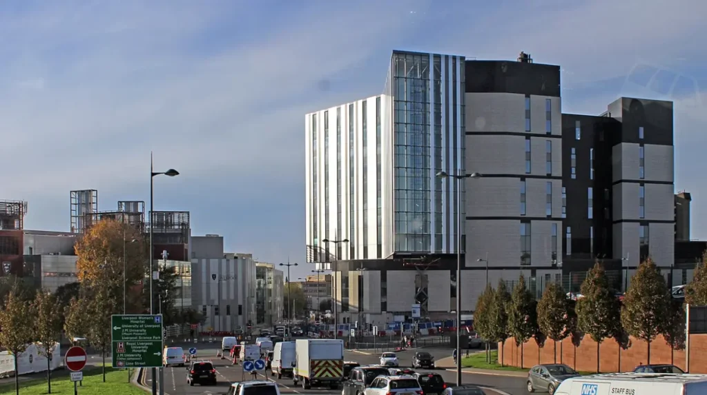
Walking from Liverpool City Centre to Kensington requires traversing 1.2 to 1.5 miles along paved, fully lit pedestrian footpaths. The walking route follows a straightforward eastbound trajectory along London Road, passing the Royal Liverpool University Hospital onto Kensington Road. The pedestrian journey takes between 22 and 30 minutes at average speeds.
The walking route begins at Saint George’s Plateau or Liverpool Lime Street Station. Pedestrians walk northeast along London Road, ascending a gentle elevation gradient toward Monument Place. London Road features wide pavements, street lighting, controlled pedestrian crossings, and commercial storefronts.
Continuing east, London Road transforms into Prescot Street near the Royal Liverpool University Hospital and Paddington Village. Pedestrians cross the junction at Low Hill, where the street officially becomes Kensington (A57). The footpath remains continuous on both sides of the roadway throughout the suburb.
Walking provides a zero-emission, predictable travel mode unaffected by vehicular traffic delays. The pedestrian corridor is equipped with signalised crossings at major intersections, including the junction at Hall Lane and Holt Road. Safety infrastructure includes closed-circuit television coverage and high-intensity urban street lighting.
Pedestrian Route Landmarks
Key visual milestones along the pedestrian path include St George’s Hall, Lime Street Station, the Royal Liverpool University Hospital, Paddington Village, and the Kensington Town Hall building.
Accessibility and Terrain
The route features paved tarmac and flagstone footpaths with drop kerbs at all roadway intersections. The terrain ascends slightly from Lime Street up London Road toward Low Hill before flattening across Kensington.
How Long Does It Take to Drive or Take a Taxi to Kensington?
Driving or taking a taxi from Liverpool City Centre to Kensington takes between 5 and 12 minutes under normal traffic conditions. The total driving distance covers 1.4 to 1.8 miles depending on the exact starting location within the city centre. Traffic flow varies based on peak commuter hours and road construction activities.
The primary vehicular route follows the A57 corridor. Drivers depart the city centre via Lime Street or Pembroke Place, joining London Road and proceeding eastbound onto Prescot Street. From Prescot Street, vehicles pass the Royal Liverpool University Hospital and continue directly onto Kensington Road.
Licensed hackney carriages (black cabs) can be hailed at designated taxi ranks, including ranks outside Lime Street Station and Queen Square. Private hire vehicle services operate through mobile dispatch applications across the city centre. Taxi fares for this journey typically range from six to ten pounds depending on traffic delays and time of day.
Motor vehicle drivers must navigate urban traffic controls, including bus lanes on London Road and speed restrictions of 20 to 30 miles per hour. On-street parking in Kensington consists of residential permit zones, pay-and-display bays, and short-term parking spaces near local commercial shops.

Route via A57 Kensington
Vehicles head east along Pembroke Place or London Road, merging onto Prescot Street (A57) and continuing straight into the heart of Kensington.
Route via Mount Pleasant and Edge Lane
Vehicles leave the southern city centre via Mount Pleasant, cross Crown Street onto Edge Lane (A5080), and turn north onto Beech Street or Holt Road to access Kensington.
What Are the Cycling Options Between Liverpool City Centre and Kensington?
Cycling from Liverpool City Centre to Kensington covers 1.3 miles and takes approximately 7 to 10 minutes. The cycle route utilizes dedicated bike lanes, shared pedestrian-cycle paths, and urban road networks. The route offers an efficient, low-cost transit method along the primary eastern transport corridor.
Cyclists departing from the city centre can travel along Pembroke Place, which features segregated cycle lanes separated from motor traffic. The route connects directly to the Knowledge Quarter cycle network near the University of Liverpool. Cyclists then proceed past Paddington Village onto Prescot Street and Kensington Road.
Liverpool City Council has installed bicycle infrastructure along this corridor to promote sustainable urban transport. Improvements include advanced stop lines for cyclists at traffic signals, directional signage, and dedicated cycle paths along key sections of the A57. Public bicycle storage stands are located near Kensington Library and local shopping parades.
E-scooters and rental bicycles operated through municipal hire schemes provide additional transit options for users without personal bicycles. Docking bays and parking zones are situated across the city centre and throughout the L7 district.
Frequently Asked Questions
What is the fastest way to get from Liverpool City Centre to Kensington?
The fastest way to reach Kensington is by taxi or car, taking 5 to 8 minutes via the A57 Prescot Street corridor. Direct bus services like the 10, 10A, or 79 take roughly 10 to 12 minutes, offering the fastest public transit option.
How much does a bus ticket cost from Liverpool City Centre to Kensington?
A standard single bus fare between Liverpool City Centre and Kensington costs two pounds under regional single-fare caps. Passengers can pay onboard using contactless cards, cash, or digital tickets via operator apps.
Is Kensington Liverpool within walking distance from Lime Street Station?
Yes, Kensington is within reasonable walking distance from Liverpool Lime Street Station. The distance is approximately 1.2 miles, which takes between 20 and 25 minutes along London Road.
Which bus stop in Liverpool City Centre goes to Kensington?
Buses to Kensington depart frequently from Queen Square Bus Station (Stands 8, 9, 10) and Liverpool ONE Bus Station. Additional pick-up points are located along London Road near Lime Street.
Does Merseyrail run direct trains to Kensington?
Merseyrail does not operate a direct train station in Kensington. Passengers using rail must take a Northern Rail service from Lime Street to Edge Hill Station, followed by a 10-minute walk north to Kensington.