
Bootle is a historic maritime town located within the Metropolitan Borough of Sefton in Merseyside, England. The settlement sits immediately north of Liverpool along the eastern bank of the River Mersey and the Leeds and Liverpool Canal. While commercial shipping and urban development define its modern landscape, the area possesses a dense concentration of architectural heritage, Victorian municipal planning, and community space. Visitors and residents routinely bypass these historic sites in favor of adjacent urban centers. Exploring the borough reveals preserved residential hunting structures, military memorials, civic buildings, and restored green spaces.
- What Is the Oldest Existing Building in Bootle?
- Why Is Bootle Town Hall a Major Architectural Landmark?
- How Does Derby Park Showcase Victorian Urban Design?
- What Role Does the Leeds and Liverpool Canal Play in Bootle?
- Where Can You Find WWII History and Memorials in Bootle?
- What Unique Cultural and Community Hubs Exist in Bootle?
- Frequently Asked Questions
Understanding the full landscape requires examining the physical locations that shaped the growth of the borough. Industrial expansion in the nineteenth century transformed the agrarian countryside into a vital shipping hub. This industrial growth left behind a detailed architectural footprint across key residential and commercial quarters. Historic parks, Grade II listed public infrastructure, and canalside developments offer direct insight into Merseyside history. Examining these locations provides a comprehensive perspective on the cultural evolution of the borough.
What Is the Oldest Existing Building in Bootle?
The oldest existing building in Bootle is the eighteenth-century Earl of Derby hunting lodge located at Merton Road. Constructed in 1773, this preserved sandstone structure predates the nineteenth-century industrial expansion and serves as a rare physical remnant of the region’s rural aristocratic estate history.
The Earl of Derby hunting lodge stands at 1 Merton Road near the Christ Church roundabout. Constructed in 1773, the building predates the arrival of deep-water docks, passenger railways, and heavy manufacturing. During the eighteenth century, the land surrounding the township functioned as a private royal and aristocratic hunting grounds populated by oak woodland and native game. The lodge provided shelter and seasonal accommodation for the Earl of Derby and visiting hunting parties.
Architecturally, the building retains its original exterior masonry and traditional structural dimensions. Notable exterior features include climbing wisteria framing the main entrance, reflecting rural residential design preceding Victorian urbanization. The survival of the lodge is remarkable given the intensive bombardment the docklands suffered during the Second World War. Today, the private residence stands directly opposite Christ Church, which was built in 1864. The contrast between the 1773 lodge and nineteenth-century infrastructure highlights the transition of the area from a rural manor into an urban borough.
Why Is Bootle Town Hall a Major Architectural Landmark?
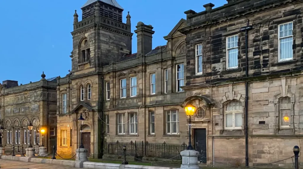
Bootle Town Hall is a major architectural landmark because it displays ornate Renaissance-style civic architecture designed by John Johnson in 1882. The Grade II listed building serves as the administrative seat of Sefton Council and houses historic military battle relics.
Situated on Oriel Road, Bootle Town Hall represents the economic prosperity of the borough during the late Victorian era. The municipal borough was incorporated in 1868 following population growth driven by Irish immigration and dockland labor. Civic leaders commissioned architect John Johnson to design a permanent administrative headquarters. Foundation stones were laid in July 1880, and the complex officially opened on April 10, 1882. The building received official Grade II listed status on January 17, 1986, recognizing its architectural significance.
The asymmetrical exterior frontage features eight distinct bays facing Oriel Road, detailed with Corinthian columns, round-headed doorways, and decorative roof dormers. Internally, the complex contains a central assembly hall decorated with stained glass windows displaying the traditional coats of arms of Lancashire towns. The building houses significant naval relics from the Battle of the Atlantic, including the ship’s bell and battle ensigns of HMS Starling, commanded by Captain Frederic John Walker. The town hall remains an active seat of local governance and community heritage displays.
How Does Derby Park Showcase Victorian Urban Design?
Derby Park showcases Victorian urban design through its preserved 1895 layout featuring elevated promenades, an ornate central bandstand, and traditional medicinal gardens. Donated by Lord Derby, the nine-hectare park is designated on the National Register of Historic Parks and Gardens.
Derby Park occupies nine hectares of land located on Oxford Road. The land was donated to the local council by Lord Derby in 1891 to establish a public park for industrial workers. Designed by the borough surveyor in 1893, the space officially opened to the public on August 17, 1895. The site is formally listed on the National Register of Historic Parks and Gardens and forms the core of the Derby Park Conservation Area.
The park layout uses a two-tiered design connected by stone staircases, separating active recreation areas from elevated walking promenades. The upper section contains a collection of rare mature tree species, including the American Elm, European Spindletree, White Poplar, Gold Chain Tree, and Atlas Cedar. At the center of the lower section stands a restored Victorian bandstand, which hosts public music events. The grounds also contain the Poulsom Memorial Statue and an adjacent medicinal garden, erected to commemorate William and Mary Poulsom for their contributions to the local hospital.
What Role Does the Leeds and Liverpool Canal Play in Bootle?
The Leeds and Liverpool Canal provides a historic water transport corridor that now serves as a scenic urban nature trail and leisure route. Constructed through the area around 1760, the canal features preserved brick wharf structures and diverse aquatic habitats.
The Leeds and Liverpool Canal passes directly through the urban core of the township. Construction of this section occurred around 1760, predating the regional passenger railway network. For over two centuries, the waterway functioned as a primary commercial route for barges transporting coal, building timber, and raw industrial material between interior Yorkshire textile mills and the Mersey docks. Massive industrial installations, such as the former Linacre Gas Works, were built directly along its banks to access barge transport.
Today, industrial barges have been replaced by recreational narrowboats, houseboats, and watercraft. The canal towpath offers a traffic-free walking trail connecting historic industrial sites, modern retail centers, and community hubs. Along the towpath near the Strand, the Lock and Quay functions as a community-run canalside venue and outdoor event space. The waterway also serves as an urban ecological corridor supporting aquatic plants such as European Frog-bit alongside species of wild waterfowl.
Where Can You Find WWII History and Memorials in Bootle?
You can find WWII history and memorials at St Mary’s Church Yard, South Park, and the Marsh Lane Art Tunnel. These sites commemorate the civilian impact of the 1941 Blitz bombing and preserve historical artifacts from the Battle of the Atlantic.
The borough sustained heavy aerial bombardment during World War II due to its proximity to the Liverpool docks and rail marshalling yards. St Mary’s Church Yard, located between Derby Road and Irlam Road, marks the former site of the borough’s oldest burial ground and original parish church. The church was destroyed during air raids in 1940 and subsequently demolished. Today, the boundary walls and historic lychgate remain intact. The graveyard contains the resting place of Jesse Hartley, the civil engineer who designed Liverpool’s Albert Dock.
South Park, situated off Balliol Road and Stanley Road, served as a vital civilian relief and relocation center during the Blitz. Families displaced by bombing raids gathered at the park for emergency housing and medical triage. South Park features the civic war memorial alongside an active community garden. Nearby, the Marsh Lane Art Tunnel provides a detailed visual timeline of the wartime home front, depicting the localized impact of aerial raids alongside railway development.
What Unique Cultural and Community Hubs Exist in Bootle?
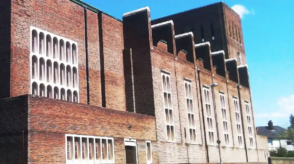
Unique cultural and community hubs in Bootle include the Salt and Tar canalside event venue and St Monica’s Church. These sites host live arts, music festivals, community gardens, and Grade I listed architectural preservation.
The cultural landscape of the borough includes both historic ecclesiastical buildings and modern performance venues. St Monica’s Church, located on Fernhill Road near the edge of Derby Park, represents a major architectural landmark. Celebrating its centenary in 2023, the Grade I listed building is recognized for its brick craftsmanship and internal architectural details. St Monica’s has continuously served the local community as a parish center and architectural landmark for over a century.
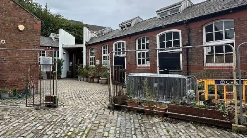
Contemporary cultural investment has led to the establishment of Salt and Tar, an outdoor venue positioned alongside the canal. This multi-use site hosts food festivals, community gatherings, and large-scale live music events. The venue features a large public mural painted by local artist Paul Curtis, which highlights prominent musical acts from Merseyside. Adjacent community spaces, including the South Park Community Garden, provide managed green spaces that host workshops and local heritage projects throughout the year.
Frequently Asked Questions
What is the most famous historical landmark in Bootle?
Bootle Town Hall on Oriel Road is widely considered the most prominent landmark due to its Grade II listing, 1882 Victorian Renaissance architecture, and collection of naval artifacts from the Battle of the Atlantic.
Can you walk along the Leeds and Liverpool Canal in Bootle?
Yes, the canal towpath provides a continuous pedestrian route passing through the town, connecting historic wharves, green parks, and community sites like the Lock and Quay venue.
Where is the oldest building in Bootle located?
The oldest building is the 1773 Earl of Derby hunting lodge, located at 1 Merton Road directly across from the Christ Church roundabout.
Are there historic public parks to visit in Bootle?
Derby Park and South Park both offer historic Victorian landscapes, mature tree collections, war memorials, and community gardens within walking distance of Oriel Road.
How far is Bootle from central Liverpool?
Bootle is located approximately three miles north of Liverpool city centre, connected by regular rail services via Bootle Oriel Road station and local bus routes.