

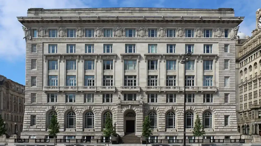
Kensington in Liverpool presents a moderate safety profile characterized by elevated urban crime rates alongside heavy police monitoring. Visitors can safely navigate main thoroughfares during daylight hours, but caution is required regarding anti-social behavior and drug-related offenses during night hours.
Kensington is an inner-city suburb located in the L7 and L6 postcode districts of Liverpool, England, situated approximately one mile east of Liverpool city center. The area operates under the jurisdiction of Merseyside Police and the Liverpool City Council. The neighborhood consists of residential streets, commercial thoroughfares, student accommodation complexes, and historic public parks.
The historical development of Kensington stems from the nineteenth-century expansion of industrial Liverpool. Victorian terrace housing was built to house dock workers, factory personnel, and trade laborers during the Industrial Revolution. Over time, the neighborhood transitioned into a diverse, high-density residential area with significant international communities and a large post-secondary student population attending local universities.
Crime statistics recorded by Merseyside Police indicate that the electoral ward of Kensington and Fairfield registers an average of sixty-one weekly offenses. The broader local authority district of Liverpool records approximately one hundred and six crimes per one thousand people annually. Anti-social behavior, petty theft, vehicle crime, and public drug offenses represent the most common incidents.
The mechanisms governing neighborhood safety involve local community policing initiatives, public surveillance systems, and urban regeneration schemes. CCTV network integration managed by Liverpool City Council operates along primary corridors including Kensington Road, Prescot Road, and Edge Lane. Merseyside Police deploys neighborhood policing teams to execute targeted patrols and reduce opportunistic street crime.
Real-world conditions vary significantly between day and night in Kensington. During daytime hours, the main thoroughfares experience heavy vehicle traffic, active retail trade, and regular pedestrian activity, creating a relatively secure environment for visitors. During nighttime hours, reduced foot traffic on side streets increases the vulnerability of unaccompanied pedestrians to opportunistic property crimes.
Statistical comparative analysis places Kensington in the mid-to-high category for crime severity across Merseyside suburbs. Data published by the UK Home Office reveals three primary offenses in the district: anti-social behavior, property damage, and drug possession. Examples of specific localized locations include Kensington High Street, Newsham Park, and the Edge Lane shopping corridor.
The safety implications for visitors depend directly on personal awareness, transport choices, and accommodation locations. Visitors staying in established student halls or private rentals along main transport links face low statistical risk when adhering to basic safety precautions. Navigating unlit side streets or isolated park land late at night elevates risk exposure significantly.
What Are the Primary Crime Statistics for Kensington in Liverpool?
Merseyside Police reports indicate Kensington records higher average crime rates than rural Merseyside, with violent crime, anti-social behavior, and drug offenses dominating local statistics. However, violent crimes against tourists remain rare throughout the L7 postcode area.
Understanding crime data requires analyzing reports generated by the UK Home Office via the national Police Information Registry. The L7 postcode district encompassing Kensington reports an average rate of approximately fifty-nine to seventy-eight recorded offenses per one thousand residents per year, depending on specific census block boundaries.
Historically, Kensington experienced economic decline following the mid-twentieth-century deindustrialization of Liverpool’s maritime economy. Reduced industrial manufacturing and port activity contributed to rising unemployment, housing decay, and systemic socio-economic challenges. These factors directly influenced crime rate trends across the inner-city residential districts throughout the late twentieth century.
The structural breakdown of local crime statistics highlights three primary categories: anti-social behavior, property crime, and public order offenses. Anti-social behavior accounts for roughly nine percent of recorded incidents, while drug-related offenses constitute eleven percent. Violence and sexual offenses comprise thirty-seven percent, though most incidents occur between acquainted individuals.
Crime prevention mechanisms rely on coordinated interventions between Merseyside Police, social housing associations, and the Liverpool Safer Communities Partnership. Intelligence-led policing targets known drug supply lines, while civil enforcement orders address recurring anti-social behavior around commercial hubs. Public lighting upgrades across side streets further aim to deter criminal activity.
A real-world illustration of law enforcement intervention is the targeted operation against street-level drug distribution along major transport routes. Police operations regularly disrupt localized drug networks, resulting in temporary reductions in associated acquisitive crimes such as shoplifting, vehicle break-ins, and street robbery across the suburb.
Research data from police repositories confirms that tourists are rarely targeted for planned major offenses in Kensington. Three examples of common minor infractions impacting visitors include phone snatching at bus stops, theft from unattended parked vehicles, and verbal harassment. Burglary rates average approximately two incidents weekly across the entire ward.
The implications of these crime statistics underline the necessity of preventive behavioral measures for all visitors. While Kensington is not an active high-risk zone for general travelers, the statistical prevalence of acquisitive crime requires visitors to secure personal belongings, avoid displaying valuable electronics openly, and utilize licensed transportation options after midnight.
Which Specific Areas in Kensington Should Visitors Be Cautious About?
Visitors should exercise heightened caution around unlit residential side streets, dark sections of Newsham Park after sunset, and quiet alleyways off Kensington Road. Well-lit primary roads and active commercial centers remain the safest areas for public foot travel.
Geographic spatial analysis reveals distinct safety variance across the different micro-zones within the Kensington neighborhood boundary. Kensington Road serves as the primary East-West artery, lined with shops, restaurants, and bus stops, maintaining high visibility and regular public activity during business operational hours.
Historically, urban density patterns created tight rows of terraced streets branching off main thoroughfares without through-traffic pathways. Built during the late Victorian era, these urban street designs feature narrow passageways and rear alleyways that present limited visual sightlines, creating spaces where unmonitored activities occur away from primary police patrols.
The spatial layout of Kensington includes three distinct zone types: commercial arteries, residential terrace streets, and public green spaces. Commercial arteries feature high surveillance and pedestrian movement. Residential side streets have variable lighting and lower foot traffic. Public green spaces, such as Newsham Park, feature expansive unlit areas after dusk.
Mechanisms of geographic risk involve reduced natural surveillance and limited emergency access points. In poorly lit secondary streets, the lack of active storefronts reduces passive monitoring by community members. In parklands, tree canopies and vast open acreage obscure visual monitoring from nearby roadway traffic networks.
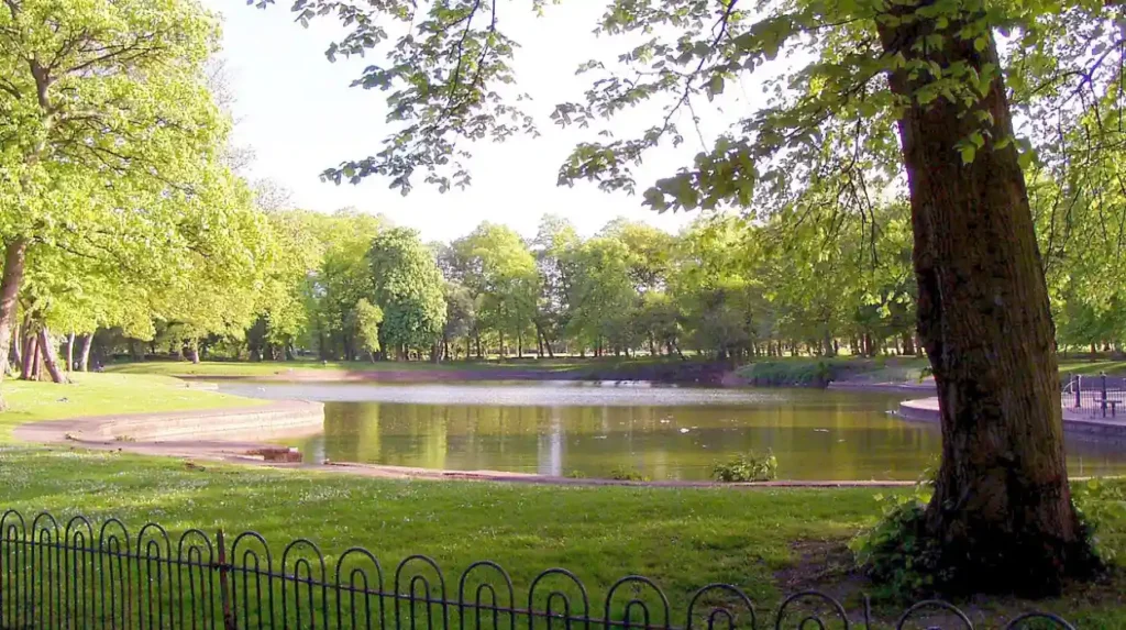
A practical example of location-based risk involves Newsham Park, a historic seventy-five-acre public park bordering Kensington, Tuebrook, and Fairfield. While highly popular for daytime recreation, jogging, and community events, the park lacks complete artificial illumination along interior walking paths, making it unsuitable for nighttime pedestrian navigation.
Data collected from community safety surveys highlights three specific locations requiring visitor awareness: secondary alleyways between Kensington Road and Boaler Street, unlit pedestrian paths in Newsham Park, and isolated parking bays near disused commercial properties. These locations report a higher density of anti-social behavior incidents.
Understanding geographic safety boundaries allows visitors to plan navigation routes effectively across eastern Liverpool. Staying on main arterial roads like Edge Lane and Kensington Road ensures access to commercial infrastructure, frequent public transit services, and municipal camera networks, minimizing exposure to localized safety hazards.
How Does Kensington Compare to Other Neighborhoods in Liverpool?
Kensington reports higher crime figures than suburban districts like Woolton or Allerton, but maintains lower overall crime rates than Liverpool City Centre and the Riverside ward. It functions as a typical inner-city transition zone.
Comparative geographic analysis positions Kensington within the broader safety framework of Merseyside. Liverpool consists of thirty wards, ranging from low-density suburban areas to high-density commercial and nightlife districts. Kensington represents an inner-ring residential district undergoing gradual urban regeneration.
The historical trajectory of Liverpool’s neighborhood development created stark economic variations between outer suburbs and inner-city wards. Suburbs such as Allerton, Woolton, and Aintree developed as low-density residential zones, whereas inner-ring areas like Kensington, Everton, and Kirkdale were constructed to support high-density labor housing.
Structuring the city by crime density reveals three operational tiers: high-density nightlife districts, mid-density inner suburbs, and low-density outer suburbs. Liverpool City Centre and Riverside experience the highest raw crime totals due to concentrated retail, alcohol consumption venues, and massive tourist traffic. Kensington falls into the middle tier alongside Picton and Tuebrook.
Statistical collection mechanisms adjust raw crime numbers against local population density to provide clear per-capita comparisons. While Liverpool overall records a crime rate of one hundred and six per one thousand residents, Kensington’s localized rate reflects high volumes of public order and drug-related incidents relative to its permanent residential base.
A real-world comparative example contrasts Kensington with the neighboring district of City Centre. While City Centre records high rates of alcohol-fueled disorder and night-time pickpocketing around entertainment venues, Kensington experiences higher rates of localized residential anti-social behavior and domestic property offenses.
Statistical comparative data across four Liverpool neighborhoods illustrates these distinct safety profiles:
- City Centre / Riverside: High crime volume, dominated by nightlife disorder and retail theft.
- Kensington and Fairfield: Moderate-high crime volume, dominated by anti-social behavior and street-level drug offenses.
- Wavertree / Picton: Moderate crime volume, heavy student population, high vehicle crime.
- Woolton / Allerton: Low crime volume, suburban residential, low overall incident rates.
The practical implication for visitors is that Kensington should not be judged alongside quiet residential suburbs or heavily polished tourist centers. It operates as a working-class, multicultural student district where basic urban safety protocols ensure a secure stay without undue concern.
What Safety Precautions Should Visitors Take When Staying in Kensington?
Visitors staying in Kensington should stick to well-lit main roads at night, secure personal belongings in public spaces, use licensed taxi services, and avoid carrying visible high-value electronics or large amounts of cash.

Implementing proactive safety measures minimizes personal security risks when visiting inner-city urban environments. Personal safety protocols focus on situational awareness, secure transportation choices, asset protection, and strategic route planning to reduce vulnerability to opportunistic crime.
Historically, urban safety strategies evolved from simple community watch programs to modern personal safety frameworks incorporating digital communication, vehicle telematics, and secure transport applications. The widespread adoption of mobile GPS navigation and ride-hailing services has drastically reduced navigation errors for non-local visitors traveling through unfamiliar urban quarters.
The key components of an effective urban personal safety routine include three foundational steps: environmental assessment, secure asset storage, and pre-planned travel routes. Environmental assessment requires monitoring surroundings for suspicious activity. Secure asset storage involves keeping purses zippered, phones concealed, and wallets in front pockets. Pre-planned travel avoids stopping in unlit areas.
Mechanisms of personal crime deterrence rely on reducing visual target profile and eliminating opportunistic windows. Perpetrators of petty theft target distracted individuals displaying high-value items like premium smartphones, designer jewelry, or open handbags. Maintaining active spatial awareness removes the element of surprise required for successful theft.
A practical example of personal risk management involves late-night transit from Liverpool Lime Street Station to accommodation in Kensington. A safety-conscious traveler books an official Hackney carriage or reputable ride-hailing vehicle directly, rather than walking unguided along quiet secondary roads with heavy luggage after dark.
Research into crime prevention strategies highlights four essential safety rules for visitors in Kensington:
- Travel along primary lit corridors like Kensington Road, Prescot Road, and Edge Lane.
- Avoid entering Newsham Park or secondary alleyways after nightfall.
- Secure all vehicle doors and remove visible personal items from car seats when parking.
- Utilize registered taxi services such as Merseytravel-licensed cabs or verified smartphone transport apps.
The long-term value of adopting these standardized urban safety habits extends beyond a visit to Kensington. Exercising prudent situational awareness, choosing safe transport modes, and avoiding isolated locations allows travelers to visit inner-city neighborhoods across the United Kingdom safely and comfortably.
Frequently Asked Questions
Is Kensington Liverpool safe to walk around at night?
Walking around Kensington at night is safe along primary well-lit thoroughfares like Kensington Road and Edge Lane where traffic passes regularly. However walking down unlit residential side streets or through Newsham Park after dark is not recommended due to increased risks of petty theft and anti-social behavior.
What is the postcode for Kensington in Liverpool?
Kensington is located within the L7 and L6 postcode districts of Liverpool. The central residential and commercial areas primarily fall under the L7 postcode, bordering the city center to the west and Edge Hill to the south.
Is Kensington in Liverpool a good place to stay for students?
Kensington is a popular accommodation district for students attending the University of Liverpool and Liverpool John Moores University due to affordable rent and proximity to campuses. Students should select secure properties along main transport links and practice standard urban personal safety.
How far is Kensington from Liverpool city center?
Kensington is located approximately one mile east of Liverpool city center. It takes about five minutes by car or taxi, ten minutes by local bus services, or twenty minutes on foot to reach major landmarks such as Liverpool Lime Street Station.
What are the main attractions near Kensington Liverpool?
Key landmarks near Kensington include the historic seventy-five-acre Newsham Park, the Victorian-era Kensington Library, and the Edge Lane retail complex. Its close proximity to the city center allows easy access to the Royal Albert Dock and the Baltic Triangle.