

The exact geographic distance between Bootle town centre and Liverpool city centre is approximately 4 miles, or 6.4 kilometers, following direct overland routes. Driving routes along the A565 highway span roughly 4.5 miles depending on the final destination.
- How Long Does It Take to Travel by Train from Bootle to Central Liverpool?
- How Long Does the Drive Take from Bootle to Liverpool City Centre?
- What Are the Bus Routes and Travel Times Between Bootle and Liverpool?
- Can You Walk or Cycle from Bootle to Liverpool City Centre?
- What Factors Cause Travel Delays Between Bootle and Liverpool?
- How Does Public Transport Cost Compare Across Different Travel Options?
- Frequently Asked Questions
Bootle is an urban maritime town located within the Metropolitan Borough of Sefton in Merseyside, England. It sits immediately north of the city of Liverpool, creating a continuous urban boundary along the eastern bank of the River Mersey. The geographical proximity between the two commercial areas makes Bootle one of the most accessible suburban locations relative to the commercial district of Liverpool. Direct linear distance measuring from Bootle Town Hall to Liverpool Town Hall records a span of less than four miles across flat coastal terrain.
The road infrastructure connecting these points relies heavily on major arterial routes, specifically the A565 road known locally as Derby Road and Rimrose Road. This corridor handles heavy freight movements bound for the Port of Liverpool as well as daily commuter transport. Travelling via these roadways creates a route distance of 4.3 to 4.8 miles to reach the Liverpool ONE shopping complex or the waterfront docks. The total journey distance changes slightly if drivers utilize secondary roads through Kirkdale and Everton.
Urban planning history reveals that Bootle expanded rapidly during the nineteenth century industrial revolution as an extension of Liverpool’s dockland network. Consequently, the geographic distance between these districts is minimized by unbroken urban infrastructure. There are no natural barriers or undeveloped rural belts separating Bootle from central Liverpool. The boundaries merge seamlessly through the northern industrial and residential districts of Kirkdale and Bankhall.
Understanding this exact geographic measurement provides a critical framework for commuters, logistics operators, and local residents calculating travel budgets. The physical short distance directly influences public transport pricing tariffs, municipal planning strategies, and residential housing valuations across the northern Merseyside region.
How Long Does It Take to Travel by Train from Bootle to Central Liverpool?
Passenger trains operated by Merseyrail complete the journey from Bootle rail stations to Liverpool city centre in 8 to 12 minutes on average. Direct train services depart every 15 minutes during peak daytime hours along the Northern Line network.
Rail transport represents the fastest, most predictable transit option between Bootle and central Liverpool due to dedicated track infrastructure. Passengers boarding at Bootle New Strand station or Bootle Oriel Road station travel directly on the Northern Line towards Liverpool Central or Moorfields stations. Trains run at frequent fifteen-minute intervals throughout the day, increasing during morning and evening rush hours to accommodate commuter volume. The total travel time from platform departure to destination arrival routinely measures precisely nine to twelve minutes.
The Merseyrail electric rail network operates underground through central Liverpool, allowing passengers from Bootle to arrive directly beneath the financial and retail districts. Stopping at Moorfields station provides immediate access to the business sector around Old Hall Street, while continuing to Liverpool Central places commuters at the shopping precinct. The journey involves minimal stopover delays, passing only through Kirkdale and Sandhills stations prior to entering the city tunnel network.
Ticket pricing structures managed by Merseytravel classify both Bootle stations within Zone 2 of the regional fare system. A standard adult single ticket costs between two and four pounds, while daily and weekly Saveaway passes offer discounted multi-modal transit across Merseyside. The low cost combined with rapid speed makes the train the dominant choice for daily workplace travel.
Seasonal schedules remain largely static throughout the year, though Sunday operations run on slightly reduced twenty-minute frequencies. The reliability of this heavy rail link shields commuters from road traffic congestion along the busy docks. Overall, rail travel provides the optimal combination of minimal transit time, affordability, and central urban access for travelers moving south from Bootle.
How Long Does the Drive Take from Bootle to Liverpool City Centre?
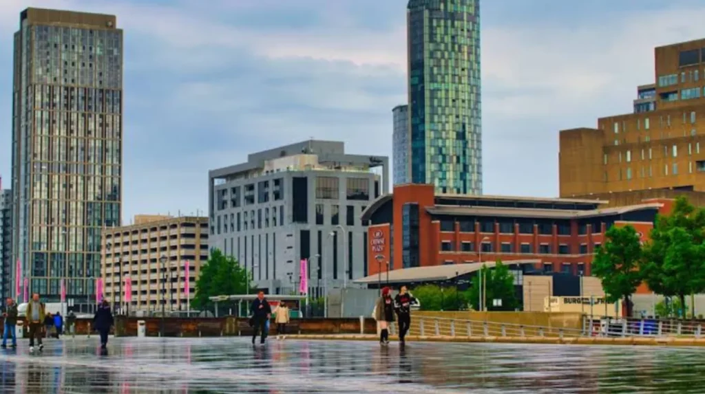
Driving from Bootle to Liverpool city centre takes between 10 to 25 minutes depending heavily on traffic conditions. The primary route follows the A565 road, which experiences significant congestion during peak morning and evening commuting hours.
Navigating a private motor vehicle from central Bootle to Liverpool city centre covers approximately 4.5 miles along major urban roadways. Under clear traffic conditions, such as early mornings or late evenings, the journey takes roughly ten to twelve minutes. Drivers typically utilize Stanley Road or proceed west toward the A565 highway, driving past the Liverpool docks before approaching the city center near the Pier Head district.
Traffic density varies dramatically according to time of day, as the A565 serves as the main freight artery for the Port of Liverpool. Morning commute hours between seven and nine o’clock routinely push driving times up to twenty-five minutes. Delays occur frequently near traffic signal junctions along Great Howard Street and around the northern boundary of the Baltic Triangle traffic distribution networks.
Alternative driving routes include traveling inland via the A5090 Hawthorne Road through Kirkdale, then connecting to the A59 Scotland Road. Scotland Road provides direct dual-carriageway access toward the Kingsway Tunnel area and central Liverpool. While this route bypasses heavy freight vehicles from the docks, local traffic signals and urban bus lanes can limit overall speed increases during busy travel periods.
Parking availability in central Liverpool further impacts total travel time for motorists driving in from Bootle. High-density commercial multi-storey car parks at Q-Park Liverpool ONE or Mount Pleasant require additional parking fees and walking time. Drivers must factor in municipal parking charges alongside fuel consumption when comparing driving against regional public transportation networks.
What Are the Bus Routes and Travel Times Between Bootle and Liverpool?
Direct bus services between Bootle Bus Station and central Liverpool take approximately 20 to 30 minutes. Regional bus operators Arriva North West and Stagecoach run direct routes every 10 to 15 minutes daily.
Bus transit provides an extensive network connecting residential streets in Bootle directly to the heart of Liverpool city centre. Key routes including the 47, 52, 53, and 300 buses depart regularly from Bootle Bus Station, located adjacent to the Strand Shopping Centre. Passengers travel through intermediate neighborhood stops in Kirkdale and Vauxhall before arriving at Queen Square Bus Station or Liverpool ONE Bus Station.
The average journey duration ranges from twenty to thirty minutes under normal urban traffic flow. Peak travel hours can extend trip durations to forty minutes due to passenger boarding stops and corridor road congestion. Arriva operates high-frequency express buses that bypass select secondary stops, offering reduced travel times during key morning commuting hours.
Bus fares across Merseyside are regulated under regional flat-rate caps, providing an affordable transport alternative to private vehicle usage. Passengers can purchase single journey passes or adult day tickets directly from vehicle operators using contactless payments or mobile applications. Multi-operator tickets allow seamless transfer between Arriva and Stagecoach vehicles across the broader Sefton and Liverpool transit zones.
Buses offer distinct accessibility benefits by providing boarding locations closer to residential neighborhoods than central railway stations. Passengers carrying heavy luggage or those residing away from Bootle New Strand rail station often prefer bus transit for direct door-to-door coverage. Night bus schedules also operate along major routes during weekends to serve late-night workers and city leisure visitors.
Can You Walk or Cycle from Bootle to Liverpool City Centre?
Walking from Bootle to Liverpool city centre takes about 1 hour and 15 minutes along a 4-mile route. Cycling takes approximately 20 to 25 minutes using dedicated cycle paths along the Leeds and Liverpool Canal.
Non-motorized transport routes offer viable, healthy, and zero-emission travel options between Bootle and central Liverpool. Pedestrians following the main roadside pavements along Stanley Road or the A565 cover roughly four miles. Walking at a standard brisk pace of three miles per hour results in a total journey time of seventy-five minutes. The urban pedestrian infrastructure features continuous street lighting, dropped kerbs, and signal-controlled pedestrian crossings throughout the route.
Bicycles provide a much faster active travel option, completing the four-mile journey in twenty to twenty-five minutes. Cyclists can utilize dedicated bicycle lanes running alongside Great Howard Street or choose the scenic off-road path along the Leeds and Liverpool Canal towpath. The canal route offers a flat, traffic-free environment starting in Bootle and emerging near the Eldonian Village, leading straight into the northern edge of the city centre.
Liverpool City Region has invested significantly in active travel corridors to encourage sustainable commuting between Sefton and the urban core. Recent highway upgrades along the A565 introduced segregated cycleways physically separated from heavy vehicular traffic. These structural improvements enhance safety for daily cycle commuters, making electric bikes and standard bicycles highly competitive against motor vehicles during heavy rush-hour traffic.
Active travel options eliminate public transit fares and parking expenses completely for daily commuters. Weather conditions along the River Mersey estuary can introduce wind and rain challenges, but the flat coastal topography makes the route physically accessible for most fitness levels. Secure bicycle parking facilities at Liverpool Lime Street and Moorfields stations further support multi-modal cycling integration.
What Factors Cause Travel Delays Between Bootle and Liverpool?
Travel delays between Bootle and Liverpool are primarily caused by peak-hour highway traffic, ongoing dockland infrastructure works, rail line maintenance, and severe weather events. Special events at Bramley-Moore Dock stadium also create localized transport delays.
Road traffic congestion represents the single largest factor extending journey times between Bootle and central Liverpool. The A565 road serves as the principal haulage route connecting the Port of Liverpool in Seaforth with national motorway networks. High volumes of heavy goods vehicles sharing lane capacity with commuter cars creates severe bottlenecks at major signalized intersections during peak morning and evening travel periods.
Infrastructure development along the Regent Road and Great Howard Street corridors frequently introduces temporary lane closures and speed restrictions. Major regeneration projects along the northern docklands, including commercial and residential builds, require utility works that temporarily disrupt traffic flow. Highway maintenance performed by local councils can divert vehicles onto congested secondary roads through Kirkdale.
Rail transit experiences occasional service disruptions due to scheduled maintenance, signal failures, or adverse weather conditions on the Merseyrail network. High winds off the Irish Sea or heavy leaf fall during autumn months can reduce train operational speeds for safety reasons. While Merseyrail maintains high punctuality rates, track incidents require emergency rail-replacement bus services that significantly increase transit times.
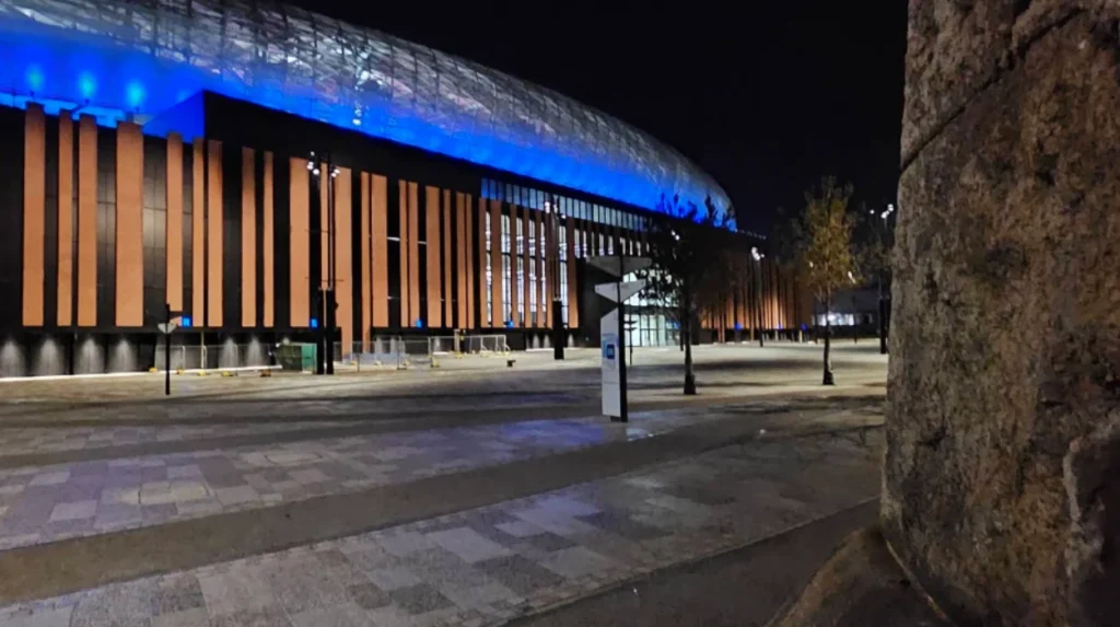
The development of Everton Football Club’s stadium at Bramley-Moore Dock along the waterfront corridor introduces large matchday crowd movements. Matchday traffic restrictions and increased pedestrian footfall along Regent Road slow down both private vehicles and public buses passing through the area. Travelers are advised to monitor real-time traffic apps and Merseytravel travel alerts before departing.
How Does Public Transport Cost Compare Across Different Travel Options?
Train travel costs between 2.00 and 4.00 pounds, bus fares cost approximately 2.00 pounds for a single fare, and taxi rides range from 12.00 to 20.00 pounds. Merseyrail train passes offer the highest overall cost efficiency for daily commuters.
Evaluating transport costs depends on travel frequency, group size, and specific destination points within Liverpool city centre. Public transport options offer significantly lower financial costs compared to private vehicle ownership or ride-hailing services. Merseytravel standard single bus tickets are capped at flat affordable rates, making local buses the cheapest choice for individual single journeys.
Merseyrail single and return train tickets fall into a similar low-cost category while delivering substantially faster travel speeds. Regular commuters benefit from weekly, monthly, or annual Railpass products, which reduce the per-journey cost to under two pounds. The Saveaway day ticket provides unlimited off-peak travel across both train and bus networks within Merseyside, maximizing financial value for day visitors.
Taxi and ride-hailing services such as Uber or local hackney carriages offer direct door-to-door convenience but at a much higher price point. A standard taxi ride from Bootle Strand to central Liverpool costs between twelve and twenty pounds depending on traffic delays and late-night tariffs. Splitting taxi costs among four passengers makes vehicle hiring competitive with public rail fares during off-peak night hours.
Private driving involves hidden operational costs, including vehicle fuel consumption, routine maintenance wear, and city centre parking charges. Parking rates in central Liverpool average three to four pounds per hour, with full-day rates often exceeding fifteen pounds. Consequently, public rail transit remains the most financially economical and time-efficient choice for daily single commuters.
Frequently Asked Questions
What is the fastest way to get from Bootle to Liverpool city centre?
The fastest way to travel from Bootle to central Liverpool is by Merseyrail train. Trains from Bootle New Strand or Bootle Oriel Road take just 8 to 12 minutes to arrive at Moorfields or Liverpool Central stations.
Is there a direct bus from Bootle Strand to Liverpool?
Yes, Arriva and Stagecoach operate multiple direct bus routes from Bootle Bus Station to Liverpool city centre. Popular routes include the 47, 52, and 53 buses, which take roughly 20 to 30 minutes.
How much does a taxi cost from Bootle to central Liverpool?
A standard taxi or ride-share fare from Bootle to central Liverpool typically costs between £12 and £20. Total fares vary based on the time of day, traffic conditions, and the specific drop-off location.
Can you walk along the canal from Bootle to Liverpool?
Yes, the Leeds and Liverpool Canal towpath provides a flat, pedestrian-friendly walking and cycling route. Cycling along the canal takes around 20 minutes, while walking takes approximately 1 hour and 15 minutes.
Is Bootle considered part of Liverpool?
Bootle is a town within the Metropolitan Borough of Sefton in Merseyside, located directly adjacent to the city of Liverpool. While politically separate under Sefton council, it shares Liverpool’s economic, transport, and cultural urban footprint.