
The best hidden gems in Huyton and Knowsley consist of Court Hey Park, Knowsley Hall Estate, Acorn Farm, Stadt Moers Park, and the historic Church of St Bartholomew. These heritage sites offer extensive greenspace, historical architecture, and cultural education.
- What Makes Court Hey Park a Historical and Ecological Asset?
- Why Is the Knowsley Hall Estate Culturally Significant?
- How Does Acorn Farm Contribute to Local Community Agriculture?
- What Environmental Features Define Stadt Moers Park?
- What Is the Architectural Significance of the Church of St Bartholomew?
- What Role Does Huyton Village Centre Play in Local Heritage?
- Frequently Asked Questions
- What are the best hidden gems in Huyton for free public access?
- How do I visit the historic Knowsley Hall estate?
- What educational activities are available at Acorn Farm in Kirkby?
- What is the historic connection between the Gladstone family and Huyton?
- How has industrial reclamation shaped green spaces in Knowsley?
The Metropolitan Borough of Knowsley sits within Merseyside in North West England. It covers an area of 86 square kilometres and has a population of approximately 154,000 residents. The borough was formed on 1 April 1974 under the Local Government Act 1972. It combined the urban districts of Huyton-with-Roby, Kirkby, and Prescot, along with parts of Whiston Rural District. Huyton serves as a primary administrative centre within this borough. The region features a mixture of suburban development, industrial heritage, and historic estate landscapes.
Historically, the township of Huyton dates back to the Anglo-Saxon period. It appears in the Domesday Book of 1086 as Hitune, which translates to high town. The area developed through agriculture before transforming into a coal mining and manufacturing hub in the 19th century. The opening of the Liverpool and Manchester Railway in 1830 accelerated industrial growth across Huyton and neighbouring settlements. Today, the region retains numerous historic structures, protected conservation areas, and community assets that document this long transformation.
The landscape includes over 80 designated public parks and open spaces across the borough. These locations host native woodland, historic walled gardens, and restored Victorian structures. Conservation designations protect these assets for ecological sustainability and public utility. Local authorities maintain these spaces through structured management plans funded by municipal budgets and heritage grants. Understanding these locations provides insight into the architectural evolution and natural environment of Merseyside.
What Makes Court Hey Park a Historical and Ecological Asset?
Court Hey Park is a 14-hectare public park containing the Gladstone family estate grounds, the former National Wildflower Centre buildings, and extensive arboretum collections. It provides structured conservation spaces, mature woodlands, and community facilities for public recreation.
Court Hey Park occupies 14 hectares of land in the Bowring Park area of the borough. The site originally formed the estate of Robertson Gladstone, brother of Prime Minister William Ewart Gladstone. Robertson Gladstone constructed Court Hey Hall on the property in 1836. The hall served as a private mansion surrounded by formal gardens, sandstone boundary walls, and specimen trees planted throughout the 19th century.
In 1919, the land was acquired by J. Bibby and Sons, a livestock feed company. The company used the grounds as an experimental farm and athletic facility for employees until the mid-20th century. Court Hey Hall was demolished in 1956 due to structural degradation, but the original stable block and walled garden were preserved. Knowsley Council acquired the property in 1951 and designated the remaining land as a public park.
Between 2000 and 2017, the courtyard and stable complex housed the National Wildflower Centre. This initiative focused on the conservation of native flora and biodiversity education across the United Kingdom. The legacy of this project persists through planted wildflower meadows, native tree varieties, and environmental research plots managed by local conservation organizations.
Today, the site operates under municipal management to serve ecological and recreational functions. Visitors can access the best free and cheap things to do around Huyton by exploring the estate’s remaining Victorian architecture and public walking trails. The park contains a community cafe, children’s play areas, and the official entrance to the Trans Pennine Trail.
Why Is the Knowsley Hall Estate Culturally Significant?
The Knowsley Hall Estate is a Grade II listed ancestral home surrounded by 2,500 acres of private parkland designed by Capability Brown. It represents over six centuries of architectural development and regional political history under the Earls of Derby.
Knowsley Hall functions as the ancestral home of the Earls of Derby. The estate traces its documented origins to the 14th century, with major structural additions occurring in the 15th, 18th, and 19th centuries. The building features a red brick exterior with stone dressings, demonstrating L-plan architectural additions from the Georgian and Victorian eras. It received Grade II listed status on 19 July 1953.
The surrounding parkland covers approximately 2,500 acres enclosed by a 15-kilometre stone wall. Landscape architect Lancelot Capability Brown redesigned the parkland during the 1770s. Brown introduced ornamental lakes, plantation woodlands, and sweeping vistas that altered the natural hydrology and topography of the site. The estate also houses rare fine art collections, including works by Edward Lear, who resided at the estate during the 1830s.
Access to the hall remains restricted because it operates as a private estate and commercial event space. However, guided heritage tours occur annually during a designated public opening week. These tours allow researchers and visitors to view the Stucco Room, State Dining Room, and historic library collections.
The broader estate accommodates the Knowsley Safari Park, which opened on 23 July 1971. The safari facility occupies 550 acres of the estate grounds and houses over 700 animals across a five-mile drive-through reserve. This commercial operation finances conservation programs and preserves the wider estate landscape.
How Does Acorn Farm Contribute to Local Community Agriculture?
Acorn Farm is an award-winning working urban farm in Kirkby that offers hands-on agricultural education, livestock interaction, and vocational training for individuals with learning disabilities. It operates as a community enterprise maintaining local farm animal breeds.
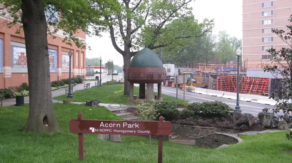
Acorn Farm was established in 1985 on a derelict urban site in Kirkby, within the Knowsley borough. The project began as a community initiative designed to provide agricultural education in an urban environment. Over four decades, the site expanded into a fully functional farm spanning several acres. It holds official charity status under the registration number 1080924.
The farm houses a diverse collection of livestock, including sheep, cows, goats, pigs, horses, and poultry. Specific rare breeds are kept to assist national conservation efforts, such as Golden Guernsey goats and Ryeland sheep. The facility maintains detailed breeding records and adheres to animal welfare standards enforced by the Department for Environment, Food and Rural Affairs.
A core function of Acorn Farm is its vocational day service for adults with learning disabilities. Participants engage in daily agricultural tasks, including animal care, horticulture, facility maintenance, and retail operations. This structured program aims to improve personal confidence, practical skills, and community integration for local participants.
The farm receives thousands of visitors annually and includes public amenities such as a plant nursery, farm shop, cafe, and educational sensory garden. The facility relies on a combination of self-generated trading income, municipal grants, and public donations. It serves as a model for urban agricultural integration in northern England.
What Environmental Features Define Stadt Moers Park?
Stadt Moers Park is a 220-acre country park situated between Huyton and Whiston, created through the reclamation of former colliery land. It contains varied wetland, grassland, and woodland habitats designed for biodiversity and public recreation.
Stadt Moers Park covers 220 acres of land along the border of Huyton and Whiston. The land was historically occupied by the Tarbock Colliery and associated heavy industrial works during the 19th and early 20th centuries. Coal extraction ceased in the mid-20th century, leaving behind contaminated soil, slag heaps, and derelict industrial infrastructure.
In the late 1970s and 1980s, Knowsley Council initiated a major land reclamation project to transform the industrial wasteland into a public country park. The park was officially named after Moers, Knowsley’s twin town in Germany. The reclamation process involved extensive earthworks, soil remediation, and the planting of over 100,000 native broadleaf and coniferous trees.
The park is divided into four distinct geographical quadrants separated by public highways and the Whiston Brook:
- Whiston Woods: A dense plantation area dedicated to timber management and woodland habitat creation.
- Tarbock Brickworks: A reclaimed industrial site converted into a nature reserve featuring exposed geological strata.
- Plersers Meadows: An open grassland zone supporting wildflower species and ground-nesting birds.
- Environment Centre Precinct: A centralized public access point featuring administrative offices, parking, and educational rooms.
The park contains several artificial lakes and reedbeds designed to manage local surface water drainage. These aquatic habitats support species such as the great crested newt, grey heron, and various dragonflies. The site is recognized as a Site of Local Importance for Nature Conservation.
Facilities within Stadt Moers Park cater to outdoor recreation and environmental monitoring. The park includes a dedicated 3-kilometre cycling track, footpaths, fishing waters, and orienteering courses. Knowsley Council’s ranger service operates from the site, coordinating volunteer conservation events and biological surveys.
What Is the Architectural Significance of the Church of St Bartholomew?
The Church of St Bartholomew in Roby is a Grade II listed Anglican parish church built in 1875 by architect Ewan Christian. It features High Victorian Gothic design, detailed ragstone masonry, stained glass, and internal Flemish relief woodcarvings.
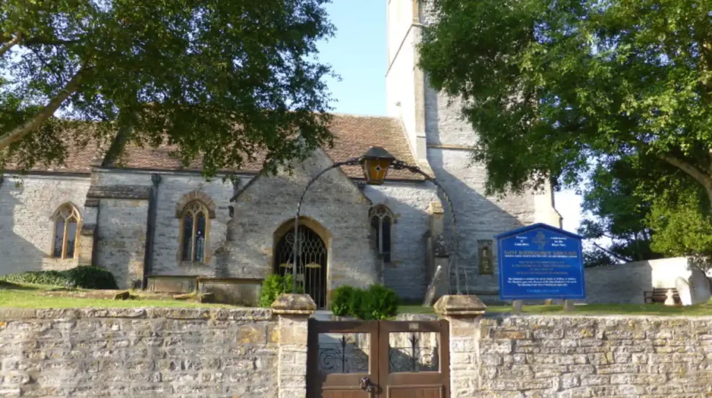
The Church of St Bartholomew is located on Church Road in the Roby district of Huyton-with-Roby. The current structure was constructed in 1875 to replace an earlier chapel of ease built in 1850. Architect Ewan Christian designed the building in the High Victorian Gothic Revival style. The structure achieved Grade II listed status on 18 March 1988.
The building is constructed from local red sandstone rubble with ashlar dressings and a steep slate roof. Architectural features include a three-stage west tower with an octagonal stair turret, lancet windows, and geometric tracery. The interior consists of a four-bay nave, north and south aisles, and a chancel supported by polished granite columns.
Steve Barnes
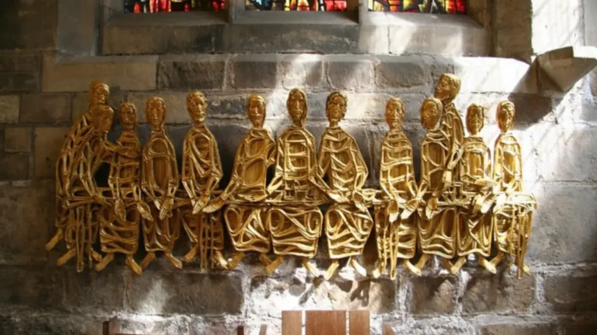
The church contains several notable historical artefacts, including 16th-century Flemish relief panels carved into the timber pulpit. The stained-glass windows were designed by notable 19th-century studios, including Shrigley and Hunt. These windows commemorate prominent local merchant families who funded the expansion of Roby during the Victorian era.
The church functions as an active place of worship within the Church of England Diocese of Liverpool. It retains its historical churchyard, which contains marked graves of notable 19th-century residents, local civic figures, and military casualties from both World Wars.
What Role Does Huyton Village Centre Play in Local Heritage?
Huyton Village Centre serves as the primary municipal and commercial core of the borough, featuring historic conservation areas, railway infrastructure, and modern civic developments. It represents the transformation from a rural village into an administrative centre.
Huyton Village Centre developed around the intersection of Derby Road, Church Road, and Blacklow Brow. The arrival of the Liverpool and Manchester Railway in 1830 transformed the rural settlement into a commuter village for wealthy Liverpool merchants. The Huyton Railway Station retains elements of its original Victorian design and remains one of the oldest active railway locations in the world.
In the mid-20th century, Huyton underwent rapid urban expansion as part of post-war slum clearance initiatives in Liverpool. Large housing estates, such as Page Moss and Woolfall Heath, were constructed adjacent to the village centre. The population expanded rapidly, prompting the construction of new civic infrastructure, including the Knowsley Council Administrative Headquarters on Archway Road.
The village centre contains a designated Conservation Area that protects historic commercial buildings along Derby Road. Architectural styles range from late Georgian brick shopfronts to mock-Tudor commercial premises constructed in the 1920s. Preserving these facades is managed through strict local planning constraints enforced by Knowsley Council.
In recent years, the village centre has undergone structured masterplanning to adapt to changing retail trends. The Huyton Village Centre Development Plan focuses on introducing independent hospitality venues, streetscape enhancements, and civic amenities. Local professionals seeking modern office environments often evaluate the best co-working options for working remotely in Huyton as part of this ongoing economic regeneration.
Frequently Asked Questions
What are the best hidden gems in Huyton for free public access?
Court Hey Park and Stadt Moers Park offer complete free public access throughout the year. Visitors can access mature woodlands, wildflower meadows, and historical walking trails without entry fees. Both sites feature dedicated parking areas, public footpaths, and community facilities maintained by Knowsley Council.
How do I visit the historic Knowsley Hall estate?
Knowsley Hall is a private residence that opens to the general public during a specialized guided tour week each year. Tickets must be pre-booked directly through the Knowsley Hall estate office ahead of the event. Visitors can also view the surrounding estate grounds year-round by visiting the adjacent Knowsley Safari Park.
What educational activities are available at Acorn Farm in Kirkby?
Acorn Farm provides structured educational tours, animal feeding sessions, and hands-on agricultural workshops for school groups and families. Visitors can learn about livestock care, rare breed conservation, and small-scale horticulture. The site also operates vocational training schemes for adults with learning disabilities.
What is the historic connection between the Gladstone family and Huyton?
Robertson Gladstone, brother of Prime Minister William Ewart Gladstone, purchased the Court Hey Estate in Huyton during the 1830s. He constructed Court Hey Hall in 1836 and established formal gardens and arboretum collections. The remaining land now forms Court Hey Park, preserving the family’s local spatial legacy.
How has industrial reclamation shaped green spaces in Knowsley?
Stadt Moers Park is the largest example of industrial land reclamation in Knowsley, transforming the former Tarbock Colliery site into a 220-acre country park. The project involved deep soil remediation, aquatic habitat creation, and the planting of 100,000 trees. The park now serves as a major wildlife sanctuary and public recreation venue.