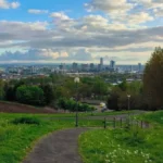


Everton Liverpool stands on an elevated ridge rising 250 feet above sea level, offering sweeping panoramic views of the River Mersey, the city skyline, and Welsh mountains while preserving rich Victorian heritage, tranquil green space, and ancient historic landmarks.
- How Did Everton Evolve From an Anglo-Saxon Settlement to an Urban Park?
- Why Is the Everton Lock-Up central to Local and Sporting History?
- What Architectural Landmarks Define the Sky Profile of Everton Ridge?
- How Does Everton Park Function as a Cultural and Environmental Asset?
- What Impact Did Urban Renewal Have on the Everton Community?
- How Can Visitors Access and Experience Everton Hilltop Today?
- Frequently Asked Questions
- What is the historic connection between Everton Football Club and Everton Lock-Up?
- Why is St George’s Church in Everton called the Iron Church?
- How high is Everton Hill and what can you see from the top?
- Was Prince Rupert ever inside Prince Rupert’s Tower in Everton?
- What happened to the old terraced streets of Everton?
Everton is a historic urban district located directly north of Liverpool city centre in North West England. The area sits atop a sandstone ridge that historically served as a natural lookout point over the Mersey Estuary. Mainstream tourism in Liverpool heavily focuses on the Royal Albert Dock, Mathew Street, and central maritime zones. Most international travelers bypass Everton due to mid-twentieth-century urban renewal projects that converted residential streets into expansive parklands. The neighbourhood combines high-elevation open spaces with historic structures, making it an underrated destination for visitors seeking cultural depth and urban landscapes.
The geography of Everton provides some of the highest natural vantage points across the Merseyside region. Standing at the crest of Everton Brow, visitors can view the Liverpool Anglican Cathedral, the Royal Liver Building, the Irish Sea, and the hills of North Wales. The area covers approximately 110 acres of modern public parkland known as Everton Park, established during the 1980s. The contrast between dense historic architecture and wide open meadows defines the current physical footprint of the district. This unique topography separates Everton from the flat, waterfront layout of central Liverpool.
The historical identity of Everton shifted from an aristocratic village into a dense industrial community during the nineteenth century. Wealthy merchants built large Georgian mansions along the ridge to escape the industrial pollution of the lower docks. Rapid urbanization during the Industrial Revolution led to high-density terraced housing construction for port workers and incoming populations. Large-scale clearance programs in the 1960s transformed the built environment into modern green space. Today, Everton remains a green sanctuary containing deep architectural and sporting origins.
How Did Everton Evolve From an Anglo-Saxon Settlement to an Urban Park?
Everton evolved from a medieval agricultural hamlet documented in the Domesday Book into an exclusive Georgian merchant retreat, followed by industrial urban expansion, mid-century housing clearance, and late-twentieth-century conversion into a landmark public parkland.
The early history of Everton traces back to early medieval England, where it operated as an agricultural hamlet within the West Derby hundred. The name originates from Old English terms signifying a higher town or wild boar settlement. Recorded as Hiretun in historic surveys, the area remained sparsely populated for centuries. In 1327, records indicate nineteen heads of household living within the township boundary. The local economy depended entirely on farming, quarrying local red sandstone, and maintaining livestock on common pasture lands.
During the English Civil War in 1644, Everton Brow played a strategic military role during the Siege of Liverpool. Royalist forces led by Prince Rupert of the Rhine established their army headquarters and artillery camp on the hilltop. The high elevation allowed military commanders to bombard Liverpool Castle and the Parliamentarian garrison below. The military encampment established Everton as a key defensive position controlling the entry points to the port. Physical reminders of this military history remain embedded in local place names and historical monuments.
The late eighteenth and early nineteenth centuries brought economic change to the hilltop. Wealthy Liverpool port merchants purchased land along Everton Ridge to construct large country houses. Population figures grew from 253 residents in 1769 to 124,414 by 1921. High-density terraced housing replaced grand estates as industrial shipping expanded. Post-war urban renewal projects in the 1960s cleared hundreds of dilapidated terraced streets. This housing removal created the open terrain that now forms Everton Park.
Why Is the Everton Lock-Up central to Local and Sporting History?
The Everton Lock-Up, built in 1787, served as a Georgian holding cell for local offenders and gained international recognition after being incorporated into the official club crest of Everton Football Club in 1938.
The Everton Lock-Up stands as an authentic eighteenth-century architectural structure on Everton Brow. Built in 1787, the small circular stone building features a distinctive conical roof made of local red sandstone. Local parish constables utilized the facility to detain individuals overnight for minor offences such as public drunkenness or disturbing the peace. Prisoners remained inside the lock-up until magistrate trials took place the following morning. It represents one of only two surviving Georgian village lock-ups within the Liverpool district.
The building holds strong alternate names rooted in local history and folklore. Commonly designated as Prince Rupert’s Tower or Prince Rupert’s Castle, the structure post-dates Prince Rupert’s 1644 encampment by 143 years. Local residents connected the site to the Royalist commander due to the proximity of his historical encampment grounds. The structure measures eight meters in diameter and features simple stone masonry designed to resist escape attempts. Historic England designated the building as a Grade II listed structure in March 1975 to preserve its physical layout.
In 1938, commercial artist Theo Kelly designed the official crest for Everton Football Club, placing the lock-up at the center of the emblem. The club originated in Everton in 1878 as St. Domingo FC before renaming in 1879. The inclusion of the tower linked the professional sports organization to its geographic birthplace. In 1997, Everton Football Club funded a fifteen thousand pound renovation project to repair the masonry. Permanent blue illumination was added to the exterior of the tower in February 2014.
What Architectural Landmarks Define the Sky Profile of Everton Ridge?
St George’s Church, constructed in 1814 with an early cast-iron structural frame, defines the skyline of Everton Ridge along with remaining Georgian townhouses, historic street layouts, and subterranean heritage structures.
St George’s Church stands as the primary architectural landmark dominating the peak of Everton Ridge. Opened in 1814, the building is known historically as the Iron Church due to its innovative internal structural framing. Architect Thomas Rickman designed the structure using pre-fabricated cast-iron components manufactured at the nearby Mersey Iron Foundry by engineer John Cragg. Cast iron forms the interior columns, window frames, roof trusses, and decorative tracery. This engineering method preceded modern metallic architectural framing used in tall structures globally.
The site of St George’s Church holds historical significance dating back to the thirteenth century. Before church construction, the plot contained the Everton Fire Beacon, erected around 1230 during the reign of King Henry III. The beacon stood twenty-five feet high and served as a regional warning signal for incoming military threats, including the Spanish Armada in 1588. A storm destroyed the old beacon tower in 1803. Developers cleared the site to make room for the church tower, which sits 250 feet above sea level.
Beyond religious buildings, Everton retains key architectural surviving elements from its nineteenth-century expansion. Georgian terraces line parts of Shaw Street and Everton Road, displaying classic brick facades, sash windows, and grand entrance portals. Below the surface of Everton Park, archaeological digs have uncovered cobbled street foundations, cellar walls, and church footings from demolished housing blocks. These buried structures preserve the structural footprint of old residential neighbourhoods. The architectural mix reflects the transition from wealthy merchant estates to industrial residential zones.
How Does Everton Park Function as a Cultural and Environmental Asset?
Everton Park functions as a 110-acre public green space providing ecological habitats, community recreational facilities, heritage trails, and high-elevation observation platforms overlooking the urban region of Liverpool.
Everton Park serves as an urban green lung situated north of Liverpool city centre. Established across cleared residential sectors, the park covers 110 acres of land featuring wildflower meadows, planted woodlands, and open grasslands. City planners designed the landscape to maximize natural biodiversity while offering expansive open-air access to urban communities. Native bird species, pollinators, and small mammals inhabit the planted tree canopies along the hillside slopes. The park connects multiple urban districts through structured walking routes and cycling paths.
The park includes key community infrastructure, such as the Everton Park Nature Garden and nearby sports centers. The Friends of Everton Park organization works alongside local authorities to maintain historical trails across the grounds. Information boards mark lost historical sites, including former schools, public houses, and churches demolished during mid-century clearances. Seasonal festivals, outdoor fitness programs, and community walks regularly take place across the hilltop paths. These events encourage community engagement while promoting local historical education.
From an urban planning perspective, Everton Park offers environmental benefits to the surrounding metropolis. The grass surfaces reduce urban water runoff during heavy rainfall events by absorbing surface rain naturally. Tree plantings help mitigate the urban heat island effect by providing shade and lowering ambient air temperatures in summer months. The elevated location provides unblocked wind corridors that move fresh marine air through the park area. This combination of ecological function and outdoor space makes the park a key asset for urban sustainability.
What Impact Did Urban Renewal Have on the Everton Community?
Mid-twentieth-century urban clearance programs relocated over 100,000 residents from Everton, replacing dense Victorian terraced housing with modern tower blocks, open parkland, and restructured suburban road networks.
Urban renewal in Everton began during the 1950s and accelerated rapidly through the 1960s and 1970s. Local government authorities designated high-density Victorian terraced streets as unfit for modern living standards due to overcrowding and aging sanitation systems. Demolition crews removed approximately 110 terraced streets, clearing thousands of brick houses built during the nineteenth century. The total population of Everton dropped from over 124,000 residents in 1921 to under 20,000 in the post-clearance era. This drop represented one of the largest demographic shifts in modern British urban history.
The physical displacement changed the social structure of the local community. Authorities resettled displaced families into new peripheral housing estates across Merseyside, including Kirkby, Skelmersdale, and Cantril Farm. Residents who remained in Everton moved into high-rise tower blocks constructed across the hillside during the late 1960s. Many of these high-rise buildings faced structural degradation and were subsequently demolished in the 1980s and 1990s. The land was converted into low-density housing developments and expanded public park space.
The modern community in Everton focuses on historic preservation and economic regeneration. Community projects preserve the memory of the Lost Tribe of Everton through publications, oral history archives, and public art. Recent housing initiatives focus on building low-rise, energy-efficient family homes that fit the natural contours of the hill. Infrastructure investments continue to connect Everton Brow directly to commercial districts in Liverpool city centre. Modern Everton combines lower population density with expanded green infrastructure.
How Can Visitors Access and Experience Everton Hilltop Today?
Visitors access Everton Hilltop via a short ten-minute bus ride or direct twenty-minute walk from Liverpool city centre, accessing historic walking trails, photography sites, and open public viewpoints.
Accessing Everton Hilltop from central Liverpool is straightforward for pedestrians and transit users. The neighborhood sits roughly 1.5 miles north of Liverpool Lime Street Railway Station. Walking routes from the city centre ascend via Shaw Street or Everton Brow, providing an uphill walk to the main viewpoints. Public bus services operate frequently from Queen Square Bus Station, taking passengers directly to Netherfield Road and Heyworth Street within ten minutes. Taxi and rideshare services drop passengers off at Everton Park Lookout points.
Self-guided walking tours offer an effective way to explore the historical highlights of Everton. A standard route begins at the Everton Lock-Up on Everton Brow, where visitors can examine the 1787 sandstone masonry. Pedestrians can walk northward through Everton Park toward St George’s Church to inspect the early nineteenth-century cast-iron architecture. Information plaques positioned along the paths provide historical context regarding demolished streets and past landmarks. Sunset hours offer clear lighting conditions for landscape photography across the Mersey Estuary.
Travelers visiting Everton should plan according to basic practical considerations. Everton Park operates as an open public space with free admission year-round. Comfortable walking shoes are recommended due to steep slopes across the ridge terrain. Visiting during daylight hours allows for clear views across the landscape to the Welsh mountains. Local amenities, cafes, and shops are located along nearby commercial corridors on Breck Road and Great Homer Street. Combining an Everton hilltop visit with surrounding heritage sites offers a complete perspective on Liverpool’s history.
Frequently Asked Questions
What is the historic connection between Everton Football Club and Everton Lock-Up?
Everton Football Club originated in Everton in 1878 as St. Domingo FC before adopting its current name in 1879. In 1938, club official Theo Kelly designed the team crest featuring the 1787 Everton Lock-Up at its centre. The tower remains an iconic symbol connecting the club to its geographic origins.
Why is St George’s Church in Everton called the Iron Church?
St George’s Church earned the name Iron Church because architect Thomas Rickman used pre-fabricated cast-iron framing for its interior structure in 1814. Cast iron made by John Cragg forms the columns, roof supports, and window frames. This technique was an early forerunner of metallic frame construction in modern architecture.
How high is Everton Hill and what can you see from the top?
Everton Hill rises approximately 250 feet above sea level at its highest ridge point. From the top of Everton Park, visitors can look out over Liverpool city centre, the River Mersey, the Wirral Peninsula, and the distant mountains of North Wales.
Was Prince Rupert ever inside Prince Rupert’s Tower in Everton?
Prince Rupert never entered the Everton Lock-Up building because it was constructed in 1787, long after his death. The tower gained his name because Royalist forces under his command encamped on Everton Brow during the Siege of Liverpool in 1644.
What happened to the old terraced streets of Everton?
During the 1960s and 1970s, urban clearance projects demolished over 110 terraced streets in Everton to eliminate aging housing. Authorities relocated over 100,000 residents and cleared the land, transforming the terrain into 110 acres of public parkland known as Everton Park.+