
Key Points
- Weather models suggest temperatures could climb as high as 41C in parts of the UK on 1 August 2026.
- The current UK record of 40.3C was set during the July 2022 heatwave.
- The Met Office has said conditions could turn “very warm” again by the start of August.
- The GFS model shows temperatures rising from 29 July, with 31C possible in south-east England.
- Highs of 30C are also forecast for southern England on 30 July and south-western areas on 31 July.
- Wales could also see 30C on 31 July, according to the model.
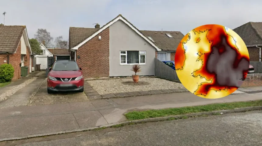
- The sharpest heat spike is projected for 1 August, with some areas from Sussex to Lincolnshire, including London, potentially reaching 40C.
- The forecast remains model-based at this stage and may change.
UK (Liverpool standard) July 20, 2026 – Britain could be on course for its hottest day on record if weather models are correct, with temperatures potentially reaching 41C during the opening days of August. The forecast, reported by the Mirror, says a fresh heatwave may build through the end of July and peak on 1 August, when the east of England could see exceptional heat.
The current UK temperature record stands at 40.3C, measured during the extreme heatwave of July 2022. That benchmark now looks under threat in the latest model runs, although the figures remain projections rather than confirmed forecasts. Meteorologists are still watching how the pattern develops in the final days of July.
What do the weather models show?
The GFS weather model points to a steady climb in temperatures from 29 July. It suggests highs of 31C in south-east England on that day, followed by 30C in southern England on 30 July. On 31 July, the model indicates that south-western areas could also hit 31C, while Wales may reach 30C as the heat spreads.
The strongest surge is shown for 1 August, when the model places 41C in parts of the east of England. A wider stretch of land from Sussex to Lincolnshire, including London, could potentially see 40C. Those figures, if realised, would place severe strain on people, services and infrastructure across the south and east.
What has the Met Office said?
As reported in the Mirror, the Met Office says conditions could turn “very warm” again by the start of August. That wording suggests growing confidence that temperatures will increase, but it does not amount to a formal heat warning in the information provided.
The distinction matters because model output can shift significantly over several days. Heatwave forecasts often move up or down as high-pressure systems strengthen or weaken, and the eventual peak can differ from early projections. For now, the main message is that another hot spell is possible rather than guaranteed.
Why does this matter now?
A forecast of 40C or 41C is not just a weather story, because temperatures at that level can affect health, travel, work and public services. Extended heat can place older people, young children and those with underlying health conditions at greater risk, especially if the heat arrives suddenly. It can also disrupt rail services, road surfaces and power demand.
For households, the main impact may be practical rather than dramatic at first: hotter nights, uncomfortable indoor conditions and higher demand for cooling. For employers, outdoor workers and event organisers, the forecast would mean a closer watch on hydration, shade and scheduling. If the model holds, early August could become a testing period for much of southern and eastern England.
What is the background to this development?
The UK has already experienced a record-breaking temperature of 40.3C in July 2022, showing that extreme heat is no longer a distant possibility. Since then, summer forecasts have increasingly drawn attention when models hint at temperatures in the high 30s or low 40s. The latest projections are part of that wider pattern of concern around more intense summer heat.
The current story is based on model data rather than an observed temperature reading. That means the reported figures should be treated as an early warning rather than a final outcome. Even so, the fact that 41C is appearing in guidance at all is enough to put forecasters, local authorities and the public on alert.
How could this affect people?
If the forecast develops as shown, people in the south and east of England are likely to feel the impact first and most strongly. London and surrounding areas could face especially uncomfortable conditions, with heat affecting commuting, outdoor work and nighttime recovery. Wales and southern England may also experience several days of very warm weather before the peak arrives.
For the wider audience, the most likely effect is increased attention to heat safety, travel disruption and possible health warnings. Schools, care settings and event organisers may need to adjust plans if temperatures climb sharply. The development could also renew debate about how prepared the UK is for more frequent extreme heat.