
Aigburth is a suburban district located in the southern part of Liverpool, England, within the L17 postcode area. The area sits along the eastern bank of the River Mersey, positioned roughly three miles south of uk/local/liverpool-city-centre/">Liverpool City Centre. Historically evolving from a medieval hamlets environment dominated by agricultural land and grand merchant estates, modern Aigburth has transitioned into a highly sought-after residential zone. It is bordered by the neighboring districts of Toxteth, Mossley Hill, Garston, and Dingle. The geographic location provides direct access to major transport corridors, coastal paths, and extensive green infrastructure, making it a pivotal urban zone within the Metropolitan Borough of Liverpool.
- What Is the History and Historical Background of Aigburth Liverpool?
- What Features Make Sefton Park a Central Attraction in Aigburth?
- What Role Does Lark Lane Play in the Community and Economy of Aigburth?
- What Facilities and Views Are Found at Otterspool Promenade?
- How Is Aigburth Connected by Local Public Transport Networks?
- What Educational Institutions and Community Amenities Operate in Aigburth?
- What Are the Real Estate and Housing Trends in Aigburth Liverpool?
- Frequently Asked Questions
The structural development of Aigburth accelerated during the nineteenth century as wealthy Liverpool merchants constructed grand villas away from the industrial city core. Today, the district exhibits a diverse architectural profile, featuring Victorian terraces, Georgian properties, mid-century housing, and modern apartment complexes. The local demographic includes a mixture of long-term residents, working professionals, families, and university students. Key landmarks such as Sefton Park, Lark Lane, and the Otterspool Promenade form the cultural and recreational spine of the community. These locations drive local tourism, support independent commercial activity, and provide significant public green space for the wider Merseyside region.
What Is the History and Historical Background of Aigburth Liverpool?
Aigburth originated as a Scandinavian settlement, taking its name from the Old Norse word Aykeberte, which translates directly to oak tree hill. During the medieval era, the land was primarily managed by religious orders, including the monks of Stanlow Abbey and later Whalley Abbey. The area remained sparsely populated, consisting mainly of farmland, woodland, and small farming hamlets through the seventeenth century. The strategic position near the River Mersey allowed early inhabitants to engage in agricultural production, fishing, and small-scale maritime trade along the riverbanks.
The industrial expansion of Liverpool during the eighteenth and nineteenth centuries transformed Aigburth into an affluent residential enclave for wealthy merchants and shipowners. Large estate houses, such as Aigburth Manor and Sudley House, were erected alongside expansive landscaped gardens to accommodate the city elite. The opening of the Liverpool, St Helens and South Lancashire Railway network and the expansion of tramways in the late nineteenth century integrated Aigburth into the broader Liverpool transit grid. Substantial residential construction followed, replacing former agricultural plots with high-density Victorian and Edwardian housing stock that defines the neighborhood today.
What Features Make Sefton Park a Central Attraction in Aigburth?
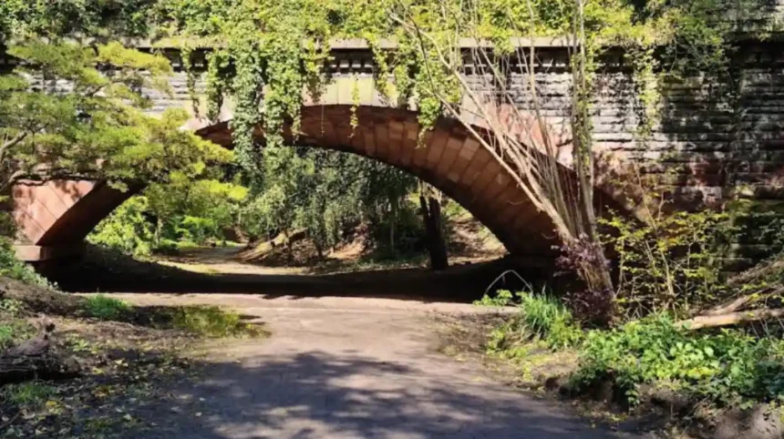
Sefton Park is a 235-acre Grade I listed public park located centrally within the Aigburth and Mossley Hill boundaries. Designed by French landscape architect Édouard André and Liverpool architect Lewis Hornblower, the park officially opened to the public in 1872. The layout incorporates expansive perimeter paths, artificial water features, curved carriageways, and naturalistic tree plantings designed to simulate rural terrain. The park serves as a major environmental asset, supporting local biodiversity, urban wildlife, and public recreational activities throughout the year.
The architectural centerpiece of Sefton Park is the Palm House, a restored Victorian glasshouse opened in 1896 that houses a collection of exotic botanical plants. The park also features a boating lake, historical monuments, decorative statues such as Peter Pan, and dedicated sports grounds. Annual events hosted within the grounds draw thousands of regional visitors, including major music festivals and community gatherings. The park is surrounded by historic Victorian villas and modern residential blocks, making it a primary structural driver for property demand and local amenity accessibility in southern Liverpool.
What Role Does Lark Lane Play in the Community and Economy of Aigburth?
Lark Lane is a commercial street running from Aigburth Road to the gates of Sefton Park, acting as the economic and cultural hub of Aigburth. The street is populated by independent businesses, including cafes, restaurants, pubs, bakeries, clothing boutiques, and art galleries. This concentration of commercial activity creates a distinct neighborhood economy separate from the centralized retail district of Liverpool City Centre. The architectural layout retains original Victorian storefront profiles, maintaining historic character while accommodating modern retail requirements.
Beyond retail commercial activity, Lark Lane serves as a social focal point for residents and visitors throughout the day and evening. The street hosts regular community events, including the Lark Lane Farmers Market, which showcases regional food producers and local craft artisans. The high density of dining establishments offers a wide variety of international cuisines, establishing the street as a prominent culinary destination within Merseyside. The close spatial connection between Lark Lane and Sefton Park creates continuous foot traffic, supporting long-term commercial sustainability for small business operators.
What Facilities and Views Are Found at Otterspool Promenade?
Otterspool Promenade is a riverside park and public walkway stretching along the bank of the River Mersey in the southern part of Aigburth. Constructed during the 1930s using material excavated from the construction of the Mersey Tunnel, the promenade converted coastal mudflats into a structured public space. The paved pathway extends over two miles, offering uninhibited views across the Mersey estuary toward the Wirral Peninsula and North Wales hills. The continuous river wall provides coastal protection while facilitating outdoor activities such as walking, cycling, running, and kite flying.
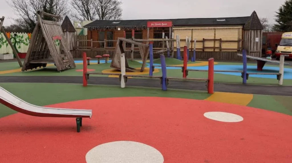
The park areas behind the promenade feature wide grassy lawns, children play facilities, designated picnic areas, and structured parking areas. Otterspool Adventure Centre operates nearby, providing outdoor recreational sports and family entertainment facilities within the park perimeter. The area is integrated into the national cycle network, providing safe non-motorized transport routes linking southern Liverpool directly to the city center. The marine environment along Otterspool supports coastal bird populations, making the area a key location for regional bird watching and environmental observation.
How Is Aigburth Connected by Local Public Transport Networks?
Aigburth possesses an integrated public transportation network connecting the district to central Liverpool, Liverpool John Lennon Airport, and wider Merseyside. The district is served primarily by Aigburth Railway Station and St Michaels Railway Station, both located on the Northern Line of the Merseyrail network. Regular electric train services operate at high frequencies throughout the week, providing transit times of under ten minutes to Liverpool Central Station. The rail infrastructure enables direct commuting options for local workers and students attending central educational institutions.
The primary road arterial passing through the district is Aigburth Road, designated as the A561, which carries high volumes of vehicular traffic. Multiple bus operators manage frequent bus routes along Aigburth Road, offering direct connections to South Liverpool suburbs, commercial parks, and central transport hubs. Dedicated cycle pathways run parallel to major roadways and along the Otterspool coastal path, promoting non-motorized transport methods. The proximity of the area to Liverpool John Lennon Airport, located four miles to the southeast, further integrates Aigburth into international transit corridors.
What Educational Institutions and Community Amenities Operate in Aigburth?
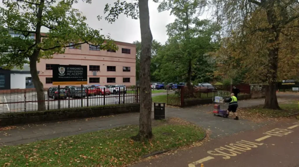
Aigburth contains a comprehensive educational infrastructure catering to primary, secondary, and higher education requirements. Notable secondary schools operating within the district boundaries include Aigburth Vale High School and St Margaret’s Church of England Academy. Primary education is provided by localized institutions such as St Michael in the Hamlet Primary School, which sits within a historic conservation area. The close proximity to the University of Liverpool and Liverpool Hope University campuses makes Aigburth a common residential base for academic staff and students.
Community amenities across Aigburth include healthcare facilities, public libraries, sports facilities, and historic heritage sites. Sudley House, located off Aigburth Road, is a historic merchant home converted into a public art gallery managed by National Museums Liverpool. The house retains its original Victorian art collection, featuring works by major artists such as J.M.W. Turner and Thomas Gainsborough. Medical services are delivered via localized NHS general practitioner surgeries, dental clinics, and nearby hospital networks like the Liverpool Women’s Hospital and Royal Liverpool University Hospital.
What Are the Real Estate and Housing Trends in Aigburth Liverpool?
The real estate market in Aigburth is characterized by strong buyer demand, consistent capital growth, and diverse property types. Housing stock ranges from mid-terrace Victorian houses near Lark Lane to large semi-detached and detached residences surrounding Sefton Park. Modern apartment conversions and newly built residential complexes along the riverfront have expanded density to accommodate growing population needs. Property prices in Aigburth consistently average higher than general citywide benchmarks due to the quality of local schools, green space proximity, and transport links.
The private rental sector in Aigburth is active, driven by young professionals, healthcare workers, and postgraduate students seeking proximity to central Liverpool. Property investors target Victorian terrace properties for conversions into high-yield rental units and houses in multiple occupation where planning regulations allow. Conservation areas, such as the St Michael in the Hamlet Conservation Area, enforce structural preservation rules to maintain original architectural heritage. Consistent investment in local infrastructure ensures that Aigburth remains one of the most stable long-term real estate markets in Merseyside.
Related Articles:
- Read about new hospitality venues in South Liverpool: Black Cat Bar Opens Fourth Liverpool Venue in Woolton Village
- Stay updated on regional infrastructure developments: Dock Branch Park £15m Scheme Update
Frequently Asked Questions
What is the postcode for Aigburth in Liverpool?
Aigburth is primarily located within the L17 postcode district in southern Liverpool. This postcode area also encompasses parts of neighboring districts such as Sefton Park and St Michael’s Hamlet.
How far is Aigburth from Liverpool City Centre?
Aigburth sits roughly three miles south of Liverpool City Centre along the River Mersey. Transit by Merseyrail train from Aigburth or St Michaels station takes under ten minutes to central stations.
Is Lark Lane suitable for family dining and daytime visits?
Lark Lane offers a family-friendly atmosphere during daytime hours with numerous independent cafes, bakeries, and casual restaurants. The street is directly adjacent to Sefton Park, making it a popular stop for families visiting the playground and green space.
Can you walk from Otterspool Promenade to central Liverpool?
Yes, a continuous paved pedestrian and cycle path runs along the River Mersey from Otterspool Promenade directly to the Albert Dock and Liverpool City Centre. The walk measures approximately three and a half miles and features flat terrain.
What are the main park amenities available inside Sefton Park?
Sefton Park features the historic Victorian Palm House, a central boating lake, children play areas, a cafe, public toilets, and formal botanical gardens. The park also contains multi-use paths for cycling and running alongside historical monuments.