

Key Points
- New free site, WalkHilbre, goes online to assist walkers on tidal crossing to Hilbre Islands from West Kirby.
- According to local web designer Daniel Chadwick, WalkHilbre uses the tide predictions that come straight from the NTSLF (National Tidal and Sea Level Facility).
- WalkHilbre incorporates the tide prediction, the weather conditions, the approved walking path (from Little Eye to Middle Eye), and the calculation of the crossing window.
- Daniel Chadwick said to Wirral Today, WalkHilbre is not meant to ensure that crossing will be safe but rather to provide users with an information basis.
- WalkHilbre website was launched in mid-September 2026 and is especially targeted at newbies of the islands.
Liverpool (Liverpool standard) September 21, 2026 – A new digital tool designed to improve safety for walkers crossing to Hilbre Island has been launched by a local developer, bringing together official tidal data, weather information and route guidance in a single, free online resource.
- Key Points
- What Is the WalkHilbre Website and How Does It Work?
- Why Was a Dedicated Hilbre Island Tidal Tracker Needed?
- What Safety Information Does WalkHilbre Provide for Walkers?
- Who Created the Hilbre Island Tidal Crossing Tool?
- How Can Walkers Access the New Hilbre Island Tide Times Website?
- Background of the Hilbre Island Tidal Walk Development
- Prediction: How This Development Can Affect Hilbre Island Walkers and Local Safety
What Is the WalkHilbre Website and How Does It Work?
The WalkHilbre website, accessible at walkhilbre.co.uk, was developed by Daniel Chadwick, a web developer and PhD researcher at the University of Liverpool whose work focuses on navigation systems, mapping and terrain data. As reported by Wirral Today, the site collects official high and low water predictions for Hilbre Island directly from the National Tidal and Sea Level Facility (NTSLF) and uses them to calculate recommended crossing windows for walkers.
According to Daniel Chadwick, the idea for WalkHilbre emerged from applying his academic and professional experience to a local safety issue. He told Wirral Today: “The idea for WalkHilbre came from applying some of that experience to a very local problem. If you want to walk out to Hilbre, you can end up checking tide times in one place, weather somewhere else, looking at the route separately and then trying to work out a sensible crossing window yourself. I thought it should be possible to bring all of that together in one clear place.”
The site displays calculated crossing windows alongside tide times, provides weather context, outlines the recognised walking route via Little Eye and Middle Eye, and offers practical safety guidance. It is intended to simplify planning for both regular visitors and those attempting the tidal walk for the first time.
Why Was a Dedicated Hilbre Island Tidal Tracker Needed?
Hilbre Island, a tidal island off the coast of West Kirby in the Wirral, is accessible on foot only during low tide. The tide returns quickly and can cut off walkers who misjudge timing, making accurate tide information essential. Existing resources for planning the walk are scattered across multiple websites, requiring users to consult separate sources for tide tables, weather forecasts and route descriptions before manually working out a safe window.
Daniel Chadwick explained to Wirral Today that consolidating this information was the primary motivation behind the project. He said:
“I hope WalkHilbre makes planning the walk easier, particularly for people who haven’t been out to the islands before. The aim isn’t to tell people that a crossing is guaranteed to be safe, but to give them a much better starting point, show the relevant information clearly and encourage them to check the conditions and local guidance before setting off.”
The developer also noted that Hilbre is a distinctive part of West Kirby and the wider Wirral, and that the project offered an opportunity to apply his research and technical skills to build something useful for the local area. In addition to WalkHilbre, Chadwick is building Page & Place, a small Wirral-based web design and digital business, and said the project brought those two sides of his work together.
What Safety Information Does WalkHilbre Provide for Walkers?
WalkHilbre presents tide predictions sourced from the NTSLF, which is the UK’s official provider of tidal and sea level data. The site uses these predictions to highlight periods around low tide when the sandbanks and causeways to Hilbre, Little Eye and Middle Eye are most likely to be exposed and passable. It also includes weather context, such as wind and visibility conditions, which can affect both the safety and comfort of the crossing.
The recognised route via Little Eye and Middle Eye is outlined on the site, reflecting the path most commonly used by experienced walkers and promoted by local authorities and rescue services. Practical safety guidance is provided to encourage walkers to check conditions, allow sufficient time to cross and return, and avoid attempting the walk in poor weather or when tide windows are narrow.
Daniel Chadwick emphasised to Wirral Today that the tool is not a substitute for personal judgement or official advice. He said the aim is to present relevant information clearly and to encourage users to check conditions and local guidance before setting off, rather than to suggest that any crossing is guaranteed to be safe.
Who Created the Hilbre Island Tidal Crossing Tool?
Daniel Chadwick, the creator of WalkHilbre, is a local web developer currently studying for a PhD at the University of Liverpool. His research focuses on navigation systems, and he has worked on projects involving mapping, terrain height data and integrating multiple data sources. As reported by Wirral Today, Chadwick applied this expertise to address the fragmented information landscape surrounding the Hilbre Island walk.
Chadwick told Wirral Today: “Hilbre is such a distinctive part of West Kirby and the Wirral, so it felt like a good opportunity to use some of my research and technical experience to build something genuinely useful for the local area.” He added that WalkHilbre emerged alongside his work on Page & Place, a small Wirral-based web design and digital business, and that the project brought those two sides of his work together.
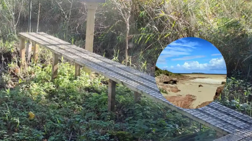
The top photograph accompanying coverage of the launch was credited to Wirral Council, indicating local authority support for efforts to improve safety awareness around the tidal walk.
How Can Walkers Access the New Hilbre Island Tide Times Website?
The WalkHilbre website is freely accessible at walkhilbre.co.uk and requires no registration or payment. Users can view tide predictions, calculated crossing windows, weather context and route information directly in their browser. The site is designed to be used on desktop and mobile devices, allowing walkers to check conditions before and during their visit to West Kirby.
Daniel Chadwick indicated to Wirral Today that the tool is particularly aimed at people who have not previously walked to Hilbre, Little Eye or Middle Eye, and who may be unfamiliar with how quickly tidal conditions can change in the Dee Estuary. By bringing together official NTSLF data, weather information and route guidance, the site seeks to reduce the risk of walkers becoming stranded or having to make emergency calls to the Coastguard.
Background of the Hilbre Island Tidal Walk Development
Hilbre Island and the adjacent islets of Little Eye and Middle Eye form a group of tidal islands in the Dee Estuary, off the coast of West Kirby in the Wirral. The islands are a local nature reserve and a popular destination for walkers, birdwatchers and visitors seeking coastal scenery. Access on foot is only possible during low tide, when sandbanks and shallow channels are exposed, creating a temporary causeway from the mainland.
The tidal range in the Dee Estuary is significant, and the tide can return quickly, cutting off walkers who remain on the islands or on the sandbanks too long. Historically, incidents involving people becoming stranded have prompted repeated safety warnings from local authorities, the Royal National Lifeboat Institution (RNLI) and HM Coastguard. Official guidance has long advised walkers to check tide times carefully, allow ample time to cross and return, and avoid the walk in poor weather or when visibility is reduced.
Prior to the launch of WalkHilbre, walkers typically consulted multiple sources, including general tide tables, Met Office beach forecasts and local council advice pages, before manually calculating a safe crossing window. The new website consolidates these elements, drawing on official NTSLF predictions and presenting them alongside route and weather information in a format designed for public use.
Prediction: How This Development Can Affect Hilbre Island Walkers and Local Safety
The introduction of a dedicated, free website that combines official tide predictions, weather context and route guidance is likely to improve planning quality for walkers attempting the crossing to Hilbre Island. By reducing the need to consult multiple sources and manually interpret tide tables, WalkHilbre may help first-time visitors and less experienced walkers to choose more appropriate times for their crossing and to build in larger safety margins.
For regular visitors, the site offers a convenient reference point that can be checked quickly before a visit, potentially reinforcing good planning habits and encouraging users to verify conditions on the day. If widely adopted, the tool could contribute to a reduction in incidents where walkers become stranded or require rescue, easing pressure on local Coastguard and RNLI resources.
However, as Daniel Chadwick himself noted to Wirral Today, the website is not intended to guarantee that any crossing is safe. Its impact will depend on how consistently walkers use it alongside other official guidance, local signage and their own judgement about weather, fitness and conditions on the ground. Over time, if usage grows and the site is promoted by local authorities and visitor centres, it could become a standard part of pre-walk planning for Hilbre Island, supporting safer access to the islands while preserving their popularity as a recreational destination.